St. Johns River Record Flood in Geneva and Sanford: Growth Must Pay for the Water
With State Road 46 closed and the St. Johns forecast to reach a record 13 feet above Lake Harney, the families who live along the river are already bearing costs that should figure in the price of new development.
4 minute read
OPINION — Fair Share
For people who take State Road 46 to work or to get their children to school, Friday morning brought a longer drive and a fuel bill to match. On Thursday night, the Florida Department of Transportation closed the road at the St. Johns River until further notice. To get from Sanford to Mims, drivers would have to go north on SR 415, east on SR 44 and south on Interstate 95, then get back on 46 at Exit 223. The people making those trips had no say in the detour. They began paying for it Friday, in time and fuel.
Early Friday near Cocoa, the St. Johns stood at 18.6 feet, a full foot above the record of 17.6 feet set in 1953. Flood stage there is 16 feet. Above Lake Harney, on Geneva’s side of Seminole County, the river reached major flood stage on Thursday and stood at 10.74 feet early Friday. It is forecast to reach a record 13 feet on Sunday. At 10.5 feet, according to the Weather Service’s impact table, water covers many secondary roads near the gauge and begins to encroach on SR 46 near Jungle Road and Prevatt Road. Sunday’s forecast is two and a half feet past that threshold. At Sanford, the river is forecast to reach 6.3 feet by Monday evening. At 6.2 feet, the impact table says, water completely surrounds many homes in the Stone Island and Still Brook subdivisions. The Citizen’s news coverage of the record flood is here.
A record is a policy document
In the coming weeks, much of the explanation will focus on the weather. There is also a public record to examine. Over the years, officials decided where to approve building, how much stormwater each development had to hold and what the public would pay for before the water rose. Those decisions determined where land was paved and drained. A record that stood for 73 years fell by a foot after a wet weekend, in a landscape reshaped by years of permits and approvals.
Clarence Howard, in his column today, warns that emergency money without a published ledger amounts to a blank check and that somebody always pays. The history of disaster spending gives him reason to insist on an accounting. The ledger can show what the flood cost. To see who bore that cost, start with the households in the Lake Poinsett area. The Weather Service says water enters homes there at 17.2 feet. On Friday, the river stood more than a foot higher.
The lever, named
Florida is under a flood emergency, declared in Executive Order 26-232, which covers 21 counties by the Citizen’s count. The decisions about who pays will come as officials allocate emergency money and the money that follows in the legislative session, and as county commissions along the river take up their stormwater and road budgets. Impact fees and stormwater charges should reflect what new development sends downstream. The budgets should fund flood protection for river communities that were there before the approvals. Developers should bear those costs as part of doing business in a floodplain.
Margaret Shepherd, in her column today, asks for the forecasts to be checked against what happened and for a tally of how much was spent in each place. Alongside that ledger, officials should publish the approval record. It should show which developments were permitted in the stretches of river that flooded, when those permits were issued and what stormwater conditions they imposed.
The river will crest this weekend and keep rising into next week at Sanford and DeLand. At DeLand, it is forecast to reach major flood stage by Tuesday. The water will eventually recede. The question of who pays the next time should be settled while the detour signs are still up.
Read the other sides of today’s crossover: Clarence Howard in The Howard Ledger and Margaret Shepherd in From the Porch, gathered on the Opinion hub.
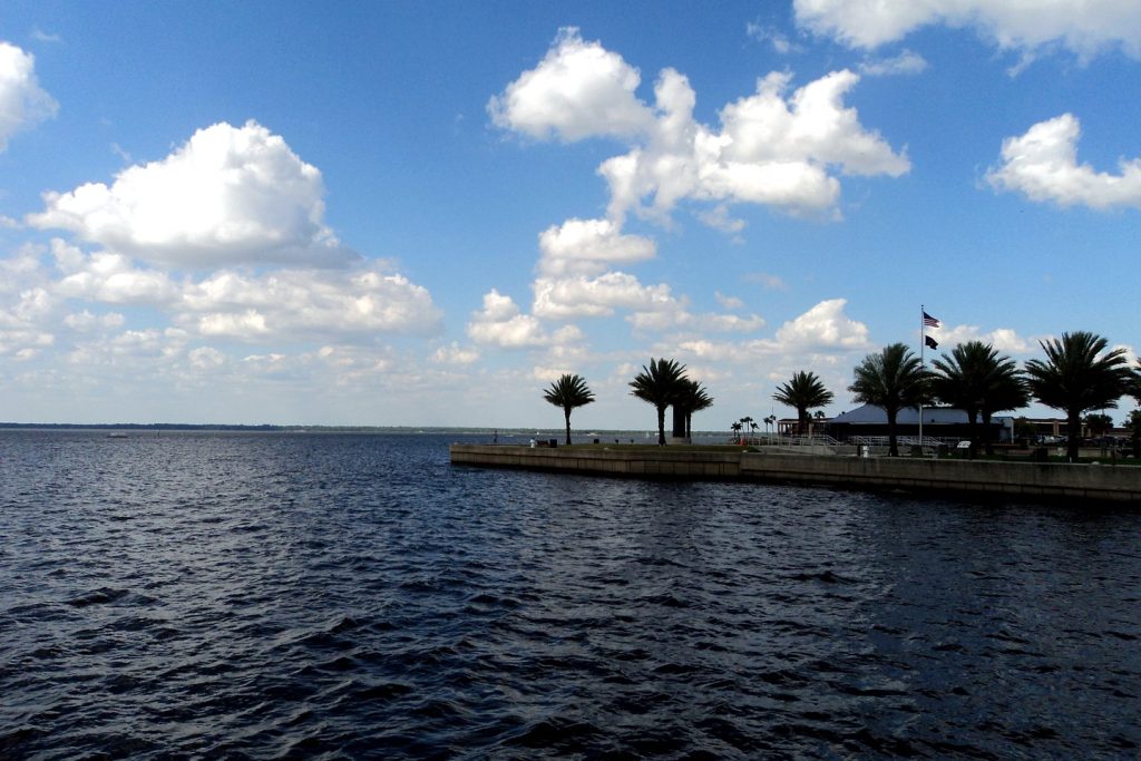
Photo: Lake Monroe at Sanford, on the St. Johns River in Seminole County. Photo: Gabriel Vanslette, CC BY, via Wikimedia Commons (file photograph).
Sources & notes
National Weather Service, Melbourne office, as reported in the Citizen’s news coverage of Nov. 19, 2026 and the Citizen’s SEO brief of Nov. 20, 2026: near Cocoa — 18.6 ft at 2:15 a.m. Fri Nov. 20, previous record 17.6 ft (1953), flood stage 16.0 ft, forecast crest 18.7 ft, 17.2-ft impacts (homes in the Lake Poinsett area west of Cocoa and low-lying homes in Rockledge’s Silver Pines subdivision; Providence Road impassable); Above Lake Harney — major flood stage reached Nov. 19, 10.74 ft at 4:30 a.m. Fri, forecast record 13 ft Sun Nov. 22, 10.5-ft impacts (secondary roads covered; SR 46 encroached near Jungle Road and Prevatt Road); Sanford — forecast 6.3 ft by Monday evening, 6.2-ft impacts (Stone Island and Still Brook subdivisions); DeLand — forecast to reach major flood by Tue Nov. 24. Florida Department of Transportation: SR 46 closed at the St. Johns River Thu night Nov. 19, until further notice, no reopening estimate, detour via SR 415 / SR 44 / I-95 (Exits 223 and 249), as reported by Florida Today, Nov. 19–20, 2026. Florida Executive Order 26-232 (21 counties), Citizen coverage, Nov. 18, 2026. “A full foot above” and “two and a half feet past” are arithmetic on the figures above.
Orlando Citizen by email
The weekly edition, in your inbox
One email, every Saturday: the week’s edition of Orlando Citizen — the week’s stories, rankings and winners, gathered in one place. Free, and you can unsubscribe at any time.
Related Stories
 OpinionDisney World Maintenance Contract Vote in Orlando: Test the Next Offer on International Drive and at HomeOpinionDisney World Maintenance Contract Vote in Orlando: Publish the Wage Ledger Before the Next OfferOpinionDisney World Maintenance Workers Reject Contract 735 to 231 in Orlando: Wages Must Catch the Cost of Living
Editor’s Picks
Spotted an error? Tell us — corrections · How we rank