Orlando Weather Today, Sunday: Harney Forecast to Crest at 13.1 Feet Tonight, Flood Warnings Hold on the St. Johns River
Even under a mostly dry Sunday sky in Orlando, the St. Johns River above Lake Harney is forecast to crest at 13.1 feet tonight as flood warnings hold at Sanford, DeLand and Astor.
5 minute read
For a family living off State Road 46 near Lake Harney, Sunday is not a day for watching the sky. The sky, for once, is mostly dry. What decides whether the night stays quiet is the river — already in their road, already past the point the Weather Service calls major flooding — and on Sunday morning the National Weather Service in Melbourne raised the expected crest once more.
Above Lake Harney, near Geneva in Seminole County, the St. Johns River stood at 12.8 feet at 7:30 a.m. Sunday, up from 12.5 feet on Saturday evening. Forecasters now expect a crest of 13.1 feet tonight, replacing this morning’s forecast of a 13.0-foot crest this weekend, before a very slow decline within major flood stage later in the week. The flooding, the Weather Service statement says, approaches the flood of record.
What the warnings say, exactly as issued
Above Lake Harney (Seminole County) — Flood Warning until further notice, issued 9:01 a.m. Sunday. Major flooding is occurring, and major flooding is forecast. At 7:30 a.m. Sunday, the river stood at 12.8 feet — the maximum stage in the 24 hours ending at 7:30 a.m., well past the 6.0-foot bankfull stage and the 8.0-foot flood stage. Forecasters call for a crest of 13.1 feet tonight, followed by a very slow decline within major flood stage later in the week. The next statement is due tonight at 11:15 p.m. EST.
Sanford (Seminole County) — Flood Warning until further notice, issued 9:08 a.m. Sunday. Moderate flooding is occurring, and major flooding is forecast. The river stood at 7.4 feet at 8:30 a.m. Sunday, up from 7.1 feet Saturday evening; bankfull stage is 4.2 feet and flood stage is 5.5 feet. A steady rise is forecast to reach 8.2 feet this week, with additional rises possible. At the 8.0-foot level, listed impacts warn that flooding becomes more significant to low-lying structures and marinas along the river in Volusia and Seminole counties, including Sanford, Enterprise and Lake Monroe. The next statement is due tonight at 11:00 p.m. EST.
DeLand (Lake and Volusia counties) — Flood Warning until further notice, issued 9:14 a.m. Sunday. Moderate flooding is occurring, and major flooding is forecast. At 8:30 a.m. Sunday, the stage was 5.3 feet, up from 5.2 feet Saturday evening, against a bankfull stage of 3.5 feet and a flood stage of 4.0 feet. The river is expected to rise into major flood stage late this weekend, reaching 6.1 feet mid to late week, with additional rises possible. At the 5.3-foot level, the warning lists major flooding to many structures and marinas along the river and in the Hontoon Island area. The next statement is due tonight at 11:00 p.m. EST.
Astor (Lake and Volusia counties) — Flood Warning until further notice, issued 9:21 a.m. Sunday. Major flooding is occurring, and major flooding is forecast. At 8:30 a.m. Sunday, the stage held at 4.1 feet, unchanged from Saturday evening; bankfull stage is 2.0 feet and flood stage is 2.3 feet. The river is forecast to hold steady near 4.1 feet early this week, with continued rises through major flood stage forecast mid to late week — a change from Saturday evening’s forecast of a gradual rise to 4.3 feet into the middle of next week. At the 4.5-foot level, listed impacts include water rescues and evacuations, most low-lying homes uninhabitable with 2 to 3 feet of water in many areas, Front Street south of State Road 40, Riveredge Drive inaccessible, and homes on Riverview Drive and Claire Street. The next statement is due tonight at 11:00 p.m. EST.
Official guidance across the warnings remains unchanged: turn around, don’t drown when encountering flooded roads; motorists should not attempt to drive around barricades or drive cars through flooded areas; and caution is urged when walking near riverbanks.
Orlando itself: a dry Sunday, rain returning Wednesday
In Orlando itself, there is no active watch or warning at the forecast point, and no warning covers Orange or Osceola counties. This afternoon is partly sunny with a high near 75 and only a slight chance of showers — a 10 percent chance of precipitation in the current forecast, up from the 2 percent in this morning’s generation — before tonight’s low settles around 60. Monday stays partly sunny near 74 and Tuesday turns mostly cloudy near 77, before Wednesday brings a chance of showers, a high near 75 and a 40 percent chance of precipitation. Thanksgiving Day is partly sunny near 72.
That midweek rain is the looming question. The Melbourne forecast discussion, issued at 2:30 a.m. Sunday, keeps dry conditions through Monday before bringing rain chances back Tuesday night into Wednesday with the next disturbance, peaking at 40 to 70 percent on Wednesday in the discussion’s regional framing. Given the ongoing flooding and saturated soils, the discussion says, additional flooding will be a concern.
One potential worry, at least, has faded. The National Hurricane Center’s 1:00 p.m. Sunday outlook says tropical cyclone formation is not expected during the next seven days — a cleaner statement than this morning’s near-zero formation chances for the offshore low, whose development is no longer in the outlook.
The 20:00 run will check for early issuance of tonight’s 11:00 p.m. river statements. If none has issued, it will say so plainly.
More from the Weather archive and the beats index. For the Sanford shore, see the Sanford hub. Earlier today: this morning’s forecast, Harney at 12.5 feet; the Citizen news desk’s crest report; and Saturday evening’s Sanford moderate-flooding update.
Sources & notes
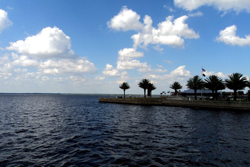
All forecast and river facts are from the National Weather Service forecast office in Melbourne: Flood Warnings issued Sunday, November 22, 2026 at 9:01 a.m. (Above Lake Harney), 9:08 a.m. (Sanford), 9:14 a.m. (DeLand) and 9:21 a.m. (Astor), read via api.weather.gov at the 1:00 p.m. check; the Orlando gridpoint forecast (MLB 26,68) generated at 12:59 p.m. EST Sunday; the Area Forecast Discussion issued 2:30 a.m. Sunday (FXUS62 KMLB 220730); and the National Hurricane Center Tropical Weather Outlook issued 1:00 p.m. Sunday (ABNT20 KNHC 221712, Forecaster Kelly). No rainfall, wind or impact figure appears here that the Weather Service did not publish. Photo: Lake Monroe at Sanford, file photograph carried from this morning’s coverage, treated to magazine grade; credit in the image caption.
Orlando Citizen by email
The weekly edition, in your inbox
One email, every Saturday: the week’s edition of Orlando Citizen — the week’s stories, rankings and winners, gathered in one place. Free, and you can unsubscribe at any time.
Related Stories
Editor’s Picks
Spotted an error? Tell us — corrections · How we rank