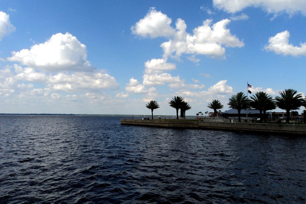
St. Johns River Flood: SR 46 Closed, Cocoa at a Record 18.6 Feet — What Friday Means for Sanford and Geneva
Drivers who rely on State Road 46 face a long detour after the St. Johns River reached a record 18.6 feet near Cocoa, with a record crest forecast near Geneva on Sunday.
4 minute read
News · Sanford
SANFORD — A Sanford driver headed to Mims or a Geneva family headed to Sanford woke on Friday to a highway they could no longer use. State Road 46 had closed at the St. Johns River on Thursday night. The water was still rising on both sides of the highway, and with a record crest forecast for the weekend, there was no date for the crossing to reopen.
The St. Johns near Cocoa reached a record 18.6 feet at 2:15 a.m. Friday and was forecast to crest at 18.7 feet, according to a Flood Statement issued at 3:10 a.m. Friday by the National Weather Service in Melbourne. At the Above Lake Harney gauge near Geneva, the river reached major flood stage on Thursday and stood at 10.74 feet at 4:30 a.m. Friday. It is forecast to crest at a record 13 feet on Sunday, November 22. The Florida Department of Transportation closed State Road 46 at the river until further notice. A Flood Watch runs through 7 p.m. Friday, with another 2 to 6 inches of rain possible today and locally 8 to 10 inches in northern Brevard and coastal Volusia.
A record at Cocoa, and what it means downstream
The previous record at Cocoa, 17.6 feet, had stood since 1953. The river passed it overnight and kept rising, reaching 18.64 feet at 5:15 a.m. and 18.66 feet at 6:15 a.m., Florida Today reported from the gauge Friday morning. Flood stage there is 16 feet. At 17.2 feet, the Weather Service says, water enters homes along the river in the Lake Poinsett area west of Cocoa and low-lying homes in Rockledge’s Silver Pines subdivision and Cocoa’s Shakespeare Park area. The Providence Road area west of Cocoa becomes impassable, cutting off access to homes in the Mullet Lane and Bass Road area. Docks at the Lone Cabbage Fish Camp flood. The warning for the Cocoa reach remains in effect until further notice. Our Thursday report traced the river’s rise to record flood levels.
Geneva and the Harney crest, due Sunday
In Seminole County, the river rose more than a foot in 24 hours at the Above Lake Harney gauge near Geneva, reaching major flood stage on Thursday. The Weather Service’s forecast of 13 feet would exceed the highest flood recorded at the gauge. The severe flood of October 2022 crested 0.3 feet below that forecast. At 10.8 feet, the warning says, water covers State Road 46 and the highway may become impassable near Jungle Road and Prevatt Road. Standing water on some secondary roads near the river deepens to more than three feet, and flooding worsens at structures and marinas from above Lake Harney to the Lake Jesup area. The Weather desk’s Wednesday report marked the onset of minor flooding in Sanford. The river has continued to rise since then.
SR 46: the closure and the detour
Rising water flooded the roadway on Thursday night, prompting FDOT to close State Road 46 at the St. Johns River in Seminole and Volusia counties. All lanes remained closed early Friday, according to FL511. The closure also affects access to and from Brevard County. In 2022, the highway was closed for weeks. FDOT advises drivers going east from Sanford to Mims to take State Road 415 north to State Road 44, follow State Road 44 east to I-95, then take I-95 south to Exit 223 for State Road 46. Going west from Mims to Sanford, drivers should take I-95 north to Exit 249, turn left onto State Road 44 west, then turn south onto State Road 415 to rejoin State Road 46.
What happens next, and when
At DeLand, the St. Johns stood at 4.4 feet on Thursday afternoon, above its 4-foot flood stage. It is forecast to reach major flood stage at 5.7 feet by Tuesday morning. At 5.3 feet, many structures and marinas along the river and in the Hontoon Island area experience major flooding. Friday’s rain will fall on saturated ground, and the Weather Service puts the Space and Volusia coasts at high risk of excessive rainfall, the highest level on its four-level scale. The Sanford hub carries this desk’s continuing river coverage, and our guide looks ahead to Sanford Porchfest’s return on February 27, 2027. For Friday, keep the State Road 46 crossing out of your plans and stay off flooded roads.
Sources & notes
Every river figure is from the National Weather Service in Melbourne: the Flood Statement for the St. Johns River near Cocoa (3:10 a.m. EST, Friday, November 20, 2026 — stage 18.6 feet at 2:15 a.m., flood stage 16.0 feet, crest forecast 18.7 feet, impacts at 17.2 feet); the Flood Statement for Above Lake Harney (Thursday evening — stage 10.3 feet at 7:30 p.m., flood stage 8.0 feet, crest forecast 13.0 feet, impacts at 10.8 feet); and the Flood Statement for DeLand (Thursday — stage 4.4 feet at 1:30 p.m., forecast 5.7 feet Tuesday morning, impacts at 5.3 feet). The 5:15 a.m. and 6:15 a.m. Cocoa readings (18.64 / 18.66 feet), the Harney 4:30 a.m. reading (10.74 feet) and the previous Cocoa record (17.6 feet, 1953) are as reported by Florida Today / USA Today from the same gauges on Friday morning. The SR 46 closure, its until-further-notice status, the FL511 all-lanes-closed report, the 2022 precedent and both detour routings are from the Florida Department of Transportation’s news release, as published Friday morning. The Flood Watch (through 7 p.m. Friday) and today’s rainfall ranges are NWS Melbourne’s. The Weather and Traffic desks own the forecast and closure records; this story is the resident-consequence update and repeats neither. Featured image: Orlando Citizen file photo, via the Thursday river report.
Orlando Citizen by email
The weekly edition, in your inbox
One email, every Saturday: the week’s edition of Orlando Citizen — the week’s stories, rankings and winners, gathered in one place. Free, and you can unsubscribe at any time.
Related Stories

Editor’s Picks
Spotted an error? Tell us — corrections · How we rank