Orlando Weather Tonight, Wednesday: Sanford Now in Minor Flooding, Harney Forecast to Reach 10.4 Feet
The St. Johns River has crossed into minor flooding at Sanford at 5.6 feet and is forecast to reach 10.4 feet near Above Lake Harney on Sunday, as Orlando faces an 80 percent chance of rain tonight with a low around 67 and forecasters watch a developing system near the northern Bahamas.
15 minute read
Weather desk — evening update, Wednesday, Nov. 18, 2026. Storm mode: a Flood Watch and four St. Johns River Flood Warnings are in effect for the Citizen’s coverage counties.
For households in the Stone Island and Still Brook subdivisions along the southern shore of Lake Monroe, the flood warning stopped being a forecast on Wednesday afternoon. At 2:30 p.m., the gauge on the St. Johns River near Sanford reached 5.6 feet — a tenth of a foot above flood stage — and less than an hour later, at 3:28 p.m., the National Weather Service in Melbourne rewrote the warning to match the rising water: minor flooding was no longer merely predicted there; it was occurring. With the river now projected to climb to 6.2 feet by Monday morning, the agency’s impact language shifted with the gauge, warning of water completely surrounding many homes in Stone Island and Still Brook, flooding pool enclosures and patios and covering many of the roads. Upstream, the river near Above Lake Harney is now expected to reach major flood stage on Friday and crest at 10.4 feet Sunday morning, with water beginning to encroach on State Road 46. Offshore, meanwhile, the National Hurricane Center’s evening outlook introduced an unsettled variable to the weekend: a low expected to form near the northern Bahamas by late Friday that could become a subtropical or tropical storm. Wednesday’s rain was supposed to be the middle of a wet week. By evening, four gauges along the St. Johns were rising, and another system was taking shape beyond the coast.
The evening facts. A Flood Watch remains in effect through 7 p.m. Friday for Orange, Seminole and Osceola counties; Lake County is not in the watch. Four Flood Warnings cover St. Johns River points in the coverage counties, all in effect until further notice: Sanford (Seminole County) — minor flooding now occurring and minor flooding forecast, 5.6 feet at 2:30 p.m. Wednesday, forecast to rise to 6.2 feet Monday morning; Above Lake Harney (Seminole County) — moderate flooding occurring and major flooding forecast, 9.1 feet at 2:30 p.m., forecast to reach major flood stage Friday and rise to 10.4 feet Sunday morning; Astor (Lake and Volusia counties) — minor flooding occurring and moderate flooding forecast, 2.9 feet at 2:30 p.m., with moderate stage now expected tonight and a rise to 3.6 feet forecast for Sunday evening; and DeLand (Lake and Volusia counties) — minor flooding forecast, 3.9 feet at 2:30 p.m., forecast to rise to 4.7 feet Monday morning. In Orlando tonight: showers and thunderstorms, a low around 67, an 80 percent chance of precipitation and new rainfall between a half and three quarters of an inch possible. The next river statements are due late tonight, at 3:15 a.m. for Astor and 3:30 a.m. for the other three points.
What changed this afternoon
The statements that this afternoon’s report had been awaiting at 11 p.m. arrived more than seven hours early — at 3:13, 3:26, 3:28 and 3:29 p.m. — and every one of them moved the outlook higher or sooner. At Sanford, flooding crossed from forecast to occurring. At Above Lake Harney, the Sunday crest forecast rose from 10.2 to 10.4 feet, pushing its impacts list up to the 10.5-foot level. At Astor, the expected arrival of moderate flood stage shifted forward from Thursday to tonight. At DeLand, the Monday forecast rose from 4.4 to 4.7 feet. Over Orlando, the sky eased slightly in the evening forecast — tonight’s rain chance is 80 percent, down from 90, with a half to three quarters of an inch possible instead of the 1 to 2 inches carried at midday — yet the river, which answers to rain that has already fallen as much as to rain still coming, did not ease at all. The Citizen’s weather coverage is collected in the Weather archive, and the desk sits on the paper’s beats index.
Sanford: minor flooding is now occurring
In Seminole County, the Flood Warning for the St. Johns River near Sanford remains in effect until further notice, carrying revised wording issued at 3:28 p.m. Wednesday: minor flooding is occurring and minor flooding is forecast, superseding this afternoon’s forecast-only phrasing. At 2:30 p.m. Wednesday, the stage stood at 5.6 feet — also the 24-hour maximum — just past the 5.5-foot flood stage and well above the 4.2-foot bankfull mark. Forecasters expect the river to rise to 6.2 feet Monday morning, with additional rises possible thereafter. As the statement’s preamble notes, additional heavy rainfall over the next few days has brought the St. Johns River at Sanford into Minor Flood Stage today, with a slow climb continuing into next week.
That climb moved the warning’s impacts from the 6.0-foot list carried this afternoon up to the 6.2-foot level. At 6.2 feet, water completely surrounds many homes in the Stone Island and Still Brook subdivisions, pool enclosures and patios become flooded, water covers many of the roads, and flooding occurs on Enterprise Road and in the Bethel Loop subdivision. Sanford‘s riverfront sits on Lake Monroe, downstream of the same rising system that has held Above Lake Harney in flood since before this desk launched. The next statement is due late tonight at 3:30 a.m.
Above Lake Harney: major flood stage expected Friday, 10.4 feet Sunday
Farther upstream in Seminole County, the Flood Warning for the St. Johns River near Above Lake Harney remains in effect until further notice under a statement issued at 3:26 p.m. Wednesday. Moderate flooding is occurring, and major flooding is forecast. The river stood at 9.1 feet at 2:30 p.m. Wednesday — unchanged from the morning reading and also the 24-hour maximum — against an 8.0-foot flood stage and a 6.0-foot bankfull stage. The river is expected to rise to 10.4 feet Sunday morning, superseding this afternoon’s 10.2-foot forecast, with additional rises possible thereafter. The statement’s preamble now attaches a day to the next threshold: heavy rainfall over recent weeks has caused river levels near Geneva, above Lake Harney, to reach Moderate Flood Stage, and additional heavy rainfall should cause the river to reach major flood stage Friday. Major flooding at Harney remains a forecast; it is not reported here as occurring.
With the higher projection, the warning shifted its impacts from the 10.0-foot list to the 10.5-foot level. At 10.5 feet, water covers many secondary roads near the river, limiting access to homes to boats or high terrain vehicles; flooding of homes along secondary roads near the river becomes more significant; and water begins to encroach on State Road 46 near Jungle Road and Prevatt Road. The next statement is due late tonight at 3:30 a.m.
Astor: moderate stage now expected tonight
Near Astor, where the St. Johns runs along Lake and Volusia counties, the Flood Warning remains in effect until further notice under a statement issued at 3:13 p.m. Wednesday. Minor flooding is occurring, and moderate flooding is forecast. The river edged up to 2.9 feet at 2:30 p.m. Wednesday — up from 2.8 feet in the morning and also the 24-hour maximum — compared with a 2.3-foot flood stage and a 2.0-foot bankfull stage. The forecast rise to 3.6 feet Sunday evening is unchanged from this afternoon, with additional rises possible thereafter. What changed is the clock: the statement now expects the river to reach moderate flood stage tonight, a day earlier than this afternoon’s Thursday expectation, driven by strong onshore flow causing a surge up the river as well as additional heavy rainfall expected in the Astor area. Moderate flooding at Astor remains a forecast until a statement reports it as occurring.
The warning’s impacts remain listed at the 3.5-foot level, a detailed tally of flooded streets and waterfronts: canals overflowing into yards; homes on or near Wildhog and Bonnet roads becoming inaccessible, with several inches of water inside homes along the river and canals; docks at the Astor Bridge marina and throughout Astor completely submerged; Bartram Road, Holiday Circle and Clair Street inaccessible; roads flooded in South Moon Fish Camp; and water breaching the sea wall at Blair’s Jungle Den. Astor is a Lake County river community. The next statement is due late tonight at 3:15 a.m.
DeLand: forecast raised to 4.7 feet Monday morning
At DeLand, affecting Lake and Volusia counties, the Flood Warning for the St. Johns River remains in effect under a 3:29 p.m. Wednesday update, with minor flooding forecast. The bulletin retains an internal discrepancy carried here as issued: its WHEN line again places the warning in effect from Thursday evening until further notice, while its forecast line again states that the river is expected to rise above flood stage this evening. At 2:30 p.m. Wednesday, the stage stood at 3.9 feet — above the 3.5-foot bankfull mark and a tenth shy of the 4.0-foot flood stage. The river is expected to continue rising to 4.7 feet Monday morning, superseding this afternoon’s 4.4 feet by Sunday morning, with additional rises possible thereafter. According to the preamble, additional heavy rainfall over the next few days is forecast to bring the river at DeLand into Minor Flood Stage tonight, with a gradual climb continuing into next week.
The higher forecast lifted its impacts from the 4.5-foot list to the 4.8-foot level, where water starts to enter low lying buildings around Hontoon Island and many secondary roads and homes in low lying areas are flooded. The next statement is due late tonight at 3:30 a.m.
All four river products carry the same guidance: motorists should not attempt to drive around barricades or drive cars through flooded areas, and caution is urged when walking near riverbanks.
The Flood Watch, Orlando’s forecast — and a new system offshore
Across the wider region, the Flood Watch issued Monday at 3:18 p.m. is unchanged, remaining in effect through 7 p.m. Friday, Nov. 20, for most of east central Florida, including Orange, Seminole and Osceola counties. Lake County remains outside the watch; the afternoon forecast discussion repeats the reason, noting that the county has less soil saturation and a better ability to absorb several inches of rain over a few days. Flooding caused by excessive rainfall is possible as repeated rounds of showers and isolated storms move through into Friday, with the watch forecasting 3 to 6 inches of rain and localized higher amounts of 8 to 12 inches, the greatest potential over the coastal counties. Its guidance urges residents to monitor later forecasts and stay alert for possible Flood Warnings, and advises those living in areas prone to flooding to be prepared to take action should flooding develop. Separate from the watch’s figures, the afternoon forecast discussion frames the rainfall as a widespread 4 to 6 inches, locally 8 to 12 inches near the coast, with a small chance of highly localized amounts over 12 inches in portions of Volusia and Brevard counties. The discussion also places portions of the coast under a Moderate Risk for excessive rainfall, level 3 out of 4, through Friday, with a Slight Risk, level 2 out of 4, for much of the interior.
One fact genuinely changed after this morning’s report, which carried the Hurricane Center’s 1 a.m. outlook stating that tropical cyclone formation was not expected in the next seven days. The National Hurricane Center’s 7 p.m. outlook replaces it: a non-tropical low pressure system is expected to form near the northern Bahamas by late Friday, and it could become a subtropical or tropical storm while moving northward or northeastward near or offshore of the southeastern U.S. coast through the weekend. Regardless of development, the outlook states, strong winds, dangerous surf and coastal flooding are likely along portions of the southeast and mid-Atlantic coasts into early next week, and interests along the eastern U.S. coast should monitor the system’s progress. Its formation chances stand near 0 percent through 48 hours and at a medium 50 percent through seven days. The Melbourne discussion states the uncertainty plainly: until the low forms there is no trackable feature; a track closer to the coast would increase rainfall and wind threats, while one farther offshore could wrap drier air into the area this weekend. No tropical watch or warning is in effect for any coverage county.
For Orlando, the forecast as NWS Melbourne frames it this evening (gridpoint MLB 26,68, generated 7:07 p.m. Wednesday):
- Tonight, Wednesday, Nov. 18: showers and thunderstorms; mostly cloudy, low around 67; east northeast wind 10 to 15 mph, gusts as high as 25 mph; chance of precipitation 80 percent; new rainfall between a half and three quarters of an inch possible.
- Thursday, Nov. 19: showers and thunderstorms; mostly cloudy, high near 75; east northeast wind around 15 mph, gusts as high as 30 mph; chance of precipitation 80 percent; new rainfall between three quarters and one inch possible. Thursday night: a chance of showers and thunderstorms, then showers and thunderstorms likely late; low around 68; chance of precipitation 60 percent; new rainfall between a half and three quarters of an inch possible.
- Friday, Nov. 20: showers and thunderstorms; mostly cloudy, high near 76; chance of precipitation 80 percent. Friday night: rain showers likely; low around 67; chance of precipitation 70 percent. The Flood Watch ends at 7 p.m. Friday.
- Saturday, Nov. 21: a chance of rain showers; partly sunny, high near 78; chance of precipitation 40 percent. Saturday night: a chance of rain showers early, then partly cloudy, low around 64, chance of precipitation 30 percent.
- Sunday, Nov. 22: mostly sunny, high near 78. Sunday night: mostly clear, low around 61.
- Monday, Nov. 23: mostly sunny, high near 78. Monday night: partly cloudy, low around 61.
- Tuesday, Nov. 24: mostly sunny, high near 79. Tuesday night: a slight chance of rain showers late, low around 63, chance of precipitation 20 percent.
- Wednesday, Nov. 25: a chance of rain showers; partly sunny, high near 77.
Three scope notes keep the edges of Wednesday’s alerts clear. A Wind Advisory issued at 6:44 p.m. Wednesday covers the coast only — coastal Volusia and Brevard counties, with east winds of 15 to 25 mph and gusts to 35 to 45 mph until 10 a.m. Thursday — alongside the standing High Surf Advisory (large breaking waves of 5 to 10 feet and dangerous rip currents, coastal counties only, through 7 p.m. Friday) and two evening Flood Advisories for the coast, covering northeastern Volusia County until 8:30 p.m. and northern Brevard County until 9:15 p.m.; none of these touches Orange, Seminole, Osceola or Lake counties. Farther south on the St. Johns, a fifth Flood Warning — for the river near Cocoa in Brevard County — remains in effect with major flooding occurring and forecast, approaching the flood of record: 17.3 feet at 2:15 p.m. Wednesday, forecast to remain steady above flood stage at 17.3 feet, with impacts listed at the 17.2-foot level. It lies outside the coverage counties and is named here only so readers following the whole river know the warning set is larger than the four points above. No heat advisory is in effect. The sequence so far runs from Tuesday evening’s report, which carried the watch taking effect, toward Thursday’s 06:00 report, which will lead with tonight’s 3:15 and 3:30 a.m. river statements.
Sources & notes
All forecast facts are the National Weather Service forecast office in Melbourne’s and the National Hurricane Center’s, checked Wednesday evening, Nov. 18, 2026, via api.weather.gov and nhc.noaa.gov: Flood Warning, St. Johns River near Astor, issued 3:13 p.m. EST Wed Nov 18 (FL.W.0003): minor flooding occurring and moderate flooding forecast; stage 2.9 ft at 2:30 p.m. Wed; flood stage 2.3 ft; bankfull 2.0 ft; 24-hour maximum 2.9 ft; forecast to rise to 3.6 ft Sunday evening, additional rises possible thereafter; preamble, moderate flood stage expected tonight on strong onshore flow and additional heavy rainfall; impacts listed at the 3.5-ft level; next statement Thu 3:15 a.m. EST. Flood Warning, St. Johns River near Above Lake Harney, issued 3:26 p.m. EST Wed Nov 18 (FL.W.0007): moderate flooding occurring and major flooding forecast; stage 9.1 ft at 2:30 p.m. Wed; flood stage 8.0 ft; bankfull 6.0 ft; 24-hour maximum 9.1 ft; forecast to rise to 10.4 ft Sunday morning, additional rises possible thereafter; preamble, major flood stage expected Friday; impacts listed at the 10.5-ft level; next statement Thu 3:30 a.m. EST. Flood Warning, St. Johns River near Sanford, issued 3:28 p.m. EST Wed Nov 18 (FL.W.0010): WHAT changed to minor flooding occurring and minor flooding forecast; stage 5.6 ft at 2:30 p.m. Wed; bankfull 4.2 ft; flood stage 5.5 ft; 24-hour maximum 5.6 ft; forecast to rise to 6.2 ft Monday morning, additional rises possible thereafter; impacts listed at the 6.2-ft level; next statement Thu 3:30 a.m. EST. Flood Warning, St. Johns River near DeLand, issued 3:29 p.m. EST Wed Nov 18 (FL.W.0009): minor flooding is forecast; WHEN from Thursday evening until further notice; stage 3.9 ft at 2:30 p.m. Wed; bankfull 3.5 ft; flood stage 4.0 ft; forecast line, river expected to rise above flood stage this evening and continue rising to 4.7 ft Monday morning, additional rises possible thereafter — the WHEN line’s Thursday-evening start and the forecast line’s this-evening rise are both the product’s wordings, carried above as issued; impacts listed at the 4.8-ft level; next statement Thu 3:30 a.m. EST. Flood Watch, issued 3:18 p.m. EST Mon Nov 16 (WGUS62 KMLB 162018, FA.A.0004), in effect Tuesday afternoon through 7 p.m. EST Fri Nov 20 for most of east central Florida including Orange, Seminole and Osceola counties; Lake County is not in the watch. Flood Warning, St. Johns River near Cocoa 9w, issued 3:25 p.m. EST Wed Nov 18 (FL.W.0006 — scope note only): major flooding occurring and forecast, approaching the flood of record; stage 17.3 ft at 2:15 p.m. Wed; flood stage 16.0 ft; bankfull 15.8 ft; forecast to remain steady above flood stage at 17.3 ft; impacts listed at the 17.2-ft level. Area Forecast Discussion, issued 3:30 p.m. EST Wed Nov 18 (FXUS62 KMLB 182338; the 6:38 p.m. product updates aviation only): key messages, discussion rainfall framing (widespread 4–6 in, locally 8–12 in near the coast, small chance highly localized 12 in+ in portions of Volusia/Brevard — labelled separately from the watch figures above), WPC Moderate Risk (Level 3 of 4) through Friday for portions of the coast and Slight Risk (Level 2 of 4) for much of the interior, the Lake County watch-exclusion reason, and the Bahamas-low discussion (which cites the Hurricane Center’s afternoon increase to 40 percent; the 7 p.m. outlook below supersedes at 50 percent). The discussion’s hydrology summary still describes the DeLand and Sanford points as forecast to reach Minor Flood Stage; for those points this report follows the river products’ own WHAT lines, which are the operative warnings. National Hurricane Center Tropical Weather Outlook, 7 p.m. EST Wed Nov 18 (ABNT20 KNHC 182326, Forecaster Kelly): non-tropical low expected to form near the northern Bahamas by late Friday; could become a subtropical or tropical storm moving northward or northeastward near or offshore of the southeastern U.S. coast through the weekend; regardless of development, strong winds, dangerous surf and coastal flooding likely along portions of the southeast and mid-Atlantic coasts into early next week; formation chance near 0 percent through 48 hours, medium 50 percent through 7 days — superseding the 1 a.m. outlook’s no-formation-expected wording, a change noted in the body above. Orlando point forecast, NWS Melbourne gridpoint MLB 26,68, generated 7:07 p.m. EST Wed Nov 18 (chances of precipitation are the forecast’s detailed-text values where the text states them, the desk’s standing practice; Sunday onward are the forecast periods’ values). Wind Advisory, issued 6:44 p.m. EST Wed Nov 18 (coastal Volusia and Brevard only, until 10 a.m. Thu). Flood Advisories, issued 6:54 p.m. EST Wed Nov 18 (northeastern Volusia County, until 8:30 p.m.) and 7:09 p.m. EST Wed Nov 18 (northern Brevard County, until 9:15 p.m.). High Surf Advisory, issued 1:25 a.m. EST Wed Nov 18 (coastal counties only). Active-alerts check via api.weather.gov on Wednesday evening: the Flood Watch is the only alert in effect at the Orlando point; no watch or warning other than the Flood Watch and the St. Johns River Flood Warnings is in effect for Orange, Seminole, Osceola or Lake counties. No figure in this report comes from any other source, and no impact is stated beyond what the products above publish.
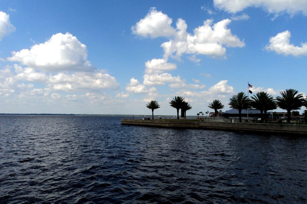
Photo: Lake Monroe at Sanford, on the St. Johns River — the featured photograph is the desk’s treated file photograph, carried from this afternoon’s report (Gabriel Vanslette, CC BY, via Wikimedia Commons).
Orlando Citizen by email
The weekly edition, in your inbox
One email, every Saturday: the week’s edition of Orlando Citizen — the week’s stories, rankings and winners, gathered in one place. Free, and you can unsubscribe at any time.
Related Stories
 WeatherOrlando Weather Today, Thursday: Astor Now in Moderate Flooding, Harney Forecast to Reach Major Flooding TonightWeatherOrlando Weather Today, Wednesday: Flood Warnings Now Cover Sanford and DeLand, Harney Forecast to Reach Major FloodingWeatherOrlando Weather Today, Wednesday: Flood Watch Through Friday, Harney Back in Moderate Flooding at 9.0 Feet
Editor’s Picks
Spotted an error? Tell us — corrections · How we rank