Orlando Weather Tonight, Thursday: Harney Now in Major Flooding, Flood Warning in Southeast Orange Until 9 P.M.
The St. Johns River above Lake Harney reached major flood stage at 10.1 feet Thursday and is forecast to crest at a record 13.0 feet early Sunday afternoon, while flooding in southeast Orange County prompted a warning until 9:00 p.m. Thursday.
9 minute read
STORM MODE — Orlando Citizen Weather desk, Thursday evening update, checked against National Weather Service Melbourne products at 8:05 p.m. EST.
For families along State Road 46 near Jungle Road and Prevatt Road, 10.8 feet is when the St. Johns River can cut off the road. At that level, the National Weather Service says, water covers the pavement and the road may become impassable. On Thursday afternoon, the river above Lake Harney near Geneva reached 10.1 feet and entered major flood stage. It is forecast to crest at 13.0 feet early Sunday afternoon, above the highest flood level ever recorded at that point, according to the Weather Service. In southeast Orange County, water was already over FL-520 at the Beachline, where a Flood Warning was in effect until 9:00 p.m.
The evening facts, all from NWS Melbourne:
- Flood Warning — southeastern Orange County and northwestern Brevard County. The warning was issued at 6:50 p.m. and runs until 9:00 p.m. Thursday. Between 3 and 7 inches of rain have fallen, and flooding caused by excessive rainfall continues. Water covers the roadway on FL-520 at the Beachline (FL-528). The warning names Wedgefield, Christmas, Lone Cabbage Fish Camp and Bithlo.
- Above Lake Harney (Seminole): major flooding is now occurring and is forecast to continue. The river reached major flood stage Thursday afternoon and stood at 10.1 feet at 1:30 p.m. It is forecast to crest at 13.0 feet early Sunday afternoon.
- Sanford (Seminole): Minor flooding is occurring, and moderate flooding is forecast. The river was at 6.1 feet at 1:30 p.m. and is forecast to rise to 7.7 feet early Tuesday morning.
- DeLand (Lake/Volusia): Minor flooding is occurring, and major flooding is forecast. The river was at 4.4 feet at 1:30 p.m. and is forecast to rise to 5.7 feet Tuesday morning.
- Astor (Lake/Volusia): The morning warning remains in effect. Moderate flooding is occurring, and major flooding is forecast. The river was at 3.2 feet at 8:30 a.m. and is forecast to rise to 4.0 feet Monday morning. The next statement is due tonight at 11:00 p.m.
- Little Wekiva River near Altamonte Springs (Seminole): The forecast now calls for minor flooding from Friday afternoon through Friday night. The river was at 26.5 feet at 3:30 p.m. Flood stage is 28.5 feet.
- Flood Watch remains in effect through Friday at 7:00 p.m. for Orange, Seminole and Osceola counties. Lake County remains outside the watch.
Flood Warning in southeast Orange County until 9 p.m.
At 6:48 p.m. Thursday, automated traffic cameras showed flooding in the area that NWS Melbourne would place under a Flood Warning two minutes later. The 6:50 p.m. warning (FA.W.0011) covers northwestern Brevard County and southeastern Orange County until 9:00 p.m. Between 3 and 7 inches of rain have fallen, and flooding caused by excessive rainfall continues. The Weather Service said flooding was imminent or already occurring along rivers, creeks and streams and in other low-lying and flood-prone locations. It identified one flooded crossing, FL-520 at the Beachline (FL-528), where water was over the roadway. The warning names Wedgefield, Christmas, Lone Cabbage Fish Camp and Bithlo, the same east Orange communities covered by the pre-dawn advisory and the midday Flash Flood Warning, which expired at 1:15 p.m.
The Weather Service advised drivers in the warning: Turn around, don’t drown when encountering flooded roads. Most flood deaths occur in vehicles. Be aware of your surroundings and do not drive on flooded roads. Readers can follow the running record in the Weather archive and find the desk’s page on the beats index.
Harney is now in major flooding, forecast to crest at 13.0 feet
The St. Johns near Geneva above Lake Harney rose from 9.7 feet at 7:30 a.m. Thursday to 10.1 feet at 1:30 p.m., its highest level in 24 hours. Flood stage is 8.0 feet, and bankfull stage is 6.0 feet. Heavy rainfall pushed the river into major flood stage that afternoon, the Weather Service said, and it is forecast to keep rising through major flood stage into early next week. The morning and midday products had reported moderate flooding and forecast major flooding. The 2:04 p.m. statement (FL.W.0007) said major flooding is occurring and major flooding is forecast. It raised the projected crest from 12.3 feet in the midday forecast to 13.0 feet early Sunday afternoon, above the all-time flood of record. At 10.8 feet, the statement says, water covers State Road 46 and the road may become impassable near Jungle Road and Prevatt Road. Standing water on secondary roads near the river deepens to more than three feet in some areas, and flooding becomes more significant at structures and marinas from above Lake Harney to the Lake Jesup area.
The Weather Service continued to urge motorists to avoid driving around barricades or through flooded areas and to use caution when walking near riverbanks. The next statement is due Friday morning at 10:15 a.m. The earlier forecast is in this morning’s Weather report. The Citizen’s news desk covered the river’s record-flood day in its Sanford and Geneva report.
Sanford and DeLand: afternoon statements raise both forecasts
At Sanford, the river rose from 5.9 feet in the morning to 6.1 feet at 1:30 p.m. Flood stage is 5.5 feet, and bankfull stage is 4.2 feet. The 2:09 p.m. statement (FL.W.0010) continued to report minor flooding and forecast a rise into moderate flood stage this weekend. It raised the midday forecast of 7.3 feet to 7.7 feet early Tuesday morning. At 7.4 feet, many secondary roads around Lake Monroe and in Enterprise are flooded and may become impassable. Rising water begins to affect more of Stone Island and approaches homes in River Oaks Estates. At 8.0 feet, flooding becomes more significant at low-lying structures and marinas along the river in Volusia and Seminole counties, including Sanford, Enterprise and Lake Monroe. The next statement is due Friday morning at 10:00 a.m.
At DeLand, heavy rain had brought the river into minor flood stage by the time of the 2:11 p.m. statement (FL.W.0009). It was at 4.4 feet at 1:30 p.m. Flood stage is 4.0 feet, and bankfull stage is 3.5 feet. The river is forecast to keep rising and reach major flood stage late this weekend into early next week. The afternoon forecast calls for 5.7 feet Tuesday morning, up from the midday projection of 5.5 feet Monday evening. At 5.3 feet, major flooding affects many structures and marinas along the river and in the Hontoon Island area. The next statement is due Friday morning at 10:00 a.m. The earlier forecast is in Wednesday night’s Weather report.
At Astor, the 9:02 a.m. warning (FL.W.0003) was still the latest at the evening check. It reported moderate flooding and forecast major flooding. The river was at 3.2 feet at 8:30 a.m. and is forecast to rise to 4.0 feet Monday morning. The warning lists the effects of flooding at 4.0 feet. The next statement is due tonight at 11:00 p.m. EST, after this report, and will lead Friday’s updates.
Little Wekiva: the forecast flooding moves to Friday
The Little Wekiva River near Altamonte Springs fell from 27.1 feet in the morning to 26.5 feet at 3:30 p.m. The midday forecast had called for minor flooding this evening at 28.7 feet. The 4:16 p.m. update (FL.W.0011) moved the warning to Friday afternoon through Friday night, with an end time of 10:16 p.m. Friday. Heavy rain is expected to redevelop across Seminole County late tonight into Friday, with 2 to 4 inches expected to raise river levels. Bankfull stage is 27.5 feet, and flood stage is 28.5 feet, when minor flooding occurs near the river in the Altamonte Springs area. The river is expected to rise to around flood stage Friday afternoon and remain in minor flood through the evening and into Friday night. The statement advises people in Altamonte Springs to turn around, don’t drown when encountering flooded roads, and to use caution when walking near riverbanks. The next statement is due Friday morning at 11:15 a.m.
The watch, the Orlando forecast, and the Bahamas low
The Flood Watch issued Monday afternoon remains in effect until 7:00 p.m. Friday for Orange, Seminole and Osceola counties in the desk’s coverage area. Lake County remains outside the watch. The forecast still calls for repeated rounds of showers and isolated storms through Friday, with 3 to 6 inches of rain and localized totals of 8 to 12 inches. Coastal counties have the greatest potential for those higher amounts. The Weather Service advised people to monitor later forecasts and watch for possible Flood Warnings. People in flood-prone areas should be ready to act if flooding develops.
In its 3:00 p.m. Thursday forecast discussion, NWS Melbourne called for a High Risk of excessive rainfall and dangerous flooding through Friday. The greatest potential is along the coast, with impacts expected inland as well. Tonight’s High Risk, level 4 of 4, covers much of Brevard County and parts of Volusia and Indian River counties, with a Slight to Moderate Risk elsewhere. From Thursday afternoon through Friday evening, the discussion forecasts additional totals of 4 to 6 inches or more in scattered to numerous locations. In what it describes as a reasonable worst case, there is a 1-in-10 chance of isolated totals of 8 to 10 inches or more, with the greatest potential from Volusia County to Indian River County. The hydrology section, issued at 6:52 p.m., said warnings remain in effect at the St. Johns River points. The river at Geneva is in major flood stage and is forecast to rise to near 13.0 feet, surpassing its all-time record by Sunday. DeLand and Astor are forecast to reach major flood stage, and Sanford is forecast to reach moderate flood stage.
In Orlando, the NWS Melbourne gridpoint forecast generated at 7:53 p.m. Thursday calls for likely rain showers tonight, a low around 68 and a 60% chance of precipitation. A quarter to a half inch is possible, with northeast winds of 10 to 15 mph gusting to 20. Friday’s forecast calls for showers and thunderstorms, a high near 74 and an 80% chance of precipitation. Between 1 and 2 inches of new rain are possible, up from three quarters to one inch in the midday forecast. Northeast winds around 15 mph could gust to 30. Friday night has a low around 67 and a 60% chance of precipitation. Saturday’s chance of showers and thunderstorms fell to 40% from 60% at midday, and the forecast high fell to near 75 from near 78. Sunday is expected to turn sunny with a high near 77. Monday is forecast to be mostly sunny with a high near 77, and Thanksgiving Day has a forecast high near 69.
The Weather Service discussion, citing the National Hurricane Center, says low pressure is forecast to develop near the northern Bahamas on Friday. It has a 60% chance of developing into a subtropical or tropical storm as it lifts northward this weekend. No tropical watch or warning is in effect for any coverage county. The St. Johns River warning near Cocoa, in Brevard County, remains in effect outside the desk’s coverage counties. The coastal High Surf Advisory also remains in effect until 7:00 p.m. Saturday, and its only overlap with the desk’s coverage is the part of Volusia County included in the river warnings.
Sources & notes
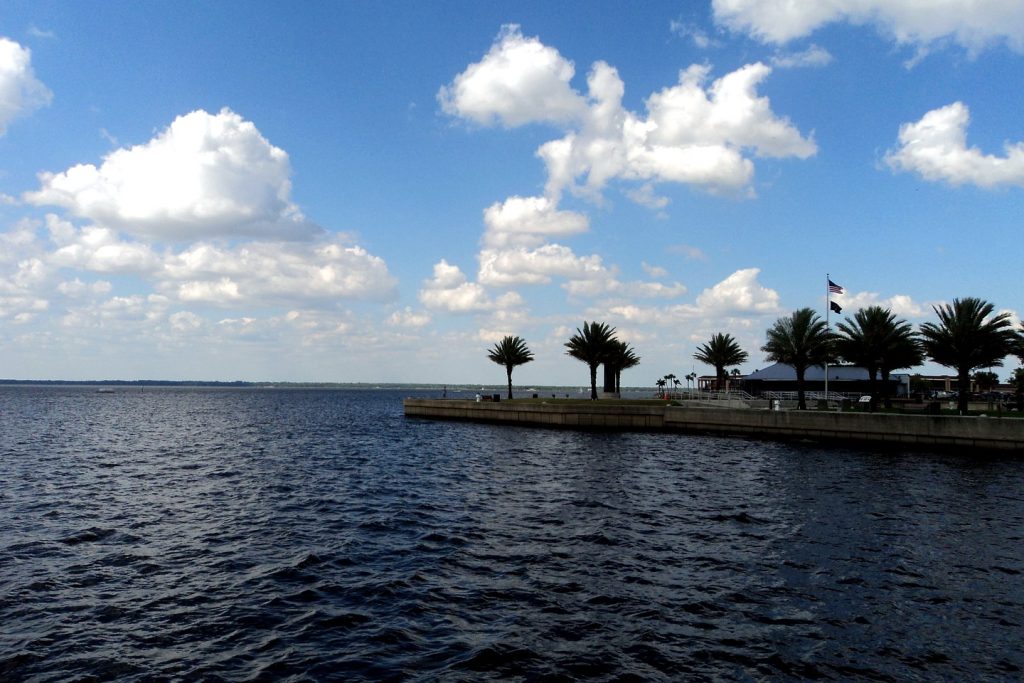
All facts are from the National Weather Service forecast office in Melbourne, checked Thursday, Nov. 19, 2026, at 8:05 p.m. EST. Flood Warning (areal), southeastern Orange/northwestern Brevard, issued 6:50 p.m. EST Thu (WGUS42 KMLB 192350, FA.W.0011, in effect until 9:00 p.m. EST Thu). Flood Statement, St. Johns River near Above Lake Harney, 2:04 p.m. EST Thu (WGUS82 KMLB 191904, FL.W.0007). Flood Statement, St. Johns River near Sanford, 2:09 p.m. EST Thu (WGUS82 KMLB 191909, FL.W.0010). Flood Statement, St. Johns River near DeLand, 2:11 p.m. EST Thu (WGUS82 KMLB 191911, FL.W.0009). Flood Warning, St. Johns River near Astor, 9:02 a.m. EST Thu (WGUS42 KMLB 191402, FL.W.0003 — no newer statement at the evening check; next due 11:00 p.m. EST Thu). Flood Statement, Little Wekiva River near Altamonte Springs, 4:16 p.m. EST Thu (WGUS82 KMLB 192116, FL.W.0011). Flood Watch, issued 3:18 p.m. EST Mon Nov. 16 (WGUS62 KMLB 162018, FA.A.0004). Area Forecast Discussion (FXUS62 KMLB 192354, 6:54 p.m. EST Thu — new aviation and hydrology; discussion and key messages issued 3:00 p.m. EST Thu, FXUS62 KMLB 192000). Orlando forecast: NWS Melbourne gridpoint MLB 26,68, generated 7:53 p.m. EST Thu Nov. 19 (detailed-text precipitation chances). Bahamas-low development probability (60%) is carried as the NWS Melbourne discussion attributes it to the National Hurricane Center; the direct NHC text route returned a stale Nov. 17 outlook to this run, so no NHC figure is carried from any other route. No figure in this report comes from any other source. Featured photograph: Lake Monroe at Sanford, by Gabriel Vanslette, CC BY via Wikimedia Commons (the desk’s treated file, reused from this morning’s Weather report).
Orlando Citizen by email
The weekly edition, in your inbox
One email, every Saturday: the week’s edition of Orlando Citizen — the week’s stories, rankings and winners, gathered in one place. Free, and you can unsubscribe at any time.
Related Stories
 WeatherOrlando Weather Today, Sunday: Harney Forecast to Crest at 13.1 Feet Tonight, Flood Warnings Hold on the St. Johns RiverWeatherOrlando Weather Today, Sunday: Harney at 12.5 Feet, Crest of 13.0 Feet Forecast This WeekendWeatherOrlando Weather Tonight, Saturday: Sanford Now in Moderate Flooding, Harney at 12.3 Feet
Editor’s Picks
Spotted an error? Tell us — corrections · How we rank