Orlando Weather Tonight, Saturday: Sanford Now in Moderate Flooding, Harney at 12.3 Feet
As the St. Johns River pushes Sanford into moderate flooding and climbs to 12.3 feet above Lake Harney toward a record crest, Orlando itself remains without a weather alert on Saturday evening.
7 minute read
For a family living along the St. Johns River near Astor, Saturday evening brings no suspense about whether the water is high. The National Weather Service in Melbourne says major flooding is already underway there, with water entering many structures along canals and the riverfront, and warns that levels will take weeks to months to drop back below flood stage. Behind every gauge reading in this report sits that reality: roads that cannot be driven, homes with water inside and a river that, by the Weather Service’s own forecast, is still climbing at its highest point near Geneva.
Fact block — Saturday evening, Nov. 21: Four Flood Warnings remain in effect until further notice on the St. Johns River in the Orlando Citizen coverage counties. Sanford is now in moderate flooding. Above Lake Harney is at 12.3 feet, in major flooding, with a crest of 13.0 feet forecast early Sunday afternoon. Astor is in major flooding at 4.0 feet. DeLand is in moderate flooding at 5.1 feet. Orlando itself has no active alert. Next NWS river statements are due tonight at 11:00 p.m. EST (11:15 p.m. for Above Lake Harney).
This is the Citizen’s Weather desk evening update. See all of the paper’s beats at /beats/.
Sanford: moderate flooding is now occurring
The sharpest turn since midday came at Sanford, in Seminole County. Where the midday statement reported minor flooding occurring, the Flood Warning issued at 1:55 p.m. EST Saturday (FL.W.0010) moved the marker upward, stating in its WHAT line that moderate flooding is occurring and major flooding is forecast. The update marks that shift explicitly because the water has crossed a new line.
At 12:30 p.m. EST Saturday, the river stood at 7.0 feet — up from 6.9 feet at 7:30 a.m. and matching the maximum stage recorded over the 24 hours ending at 12:30 p.m. Flood stage is 5.5 feet, and bankfull stage is 4.2 feet. Forecasters expect the river to climb to 8.1 feet by Wednesday morning, with additional rises possible thereafter; the warning’s preamble projects levels rising through moderate flood stage over the weekend and reaching major flood stage by the middle of next week.
At 8.0 feet, the Weather Service notes, flooding grows more significant for low-lying structures and marinas along the river in Volusia and Seminole counties, including Sanford, Enterprise and Lake Monroe. Area hub: Sanford.
Above Lake Harney: 12.3 feet, crest of 13.0 feet forecast Sunday
Upstream near Geneva, in Seminole County, the river is pushing into uncharted territory. The Flood Warning for the St. Johns River above Lake Harney, issued at 1:52 p.m. EST Saturday (FL.W.0007), remains in effect until further notice, with major flooding occurring, major flooding forecast and the projected water level sitting above the all-time flood of record.
At 12:30 p.m. EST Saturday, the gauge read 12.3 feet, up from 12.2 feet at 7:30 a.m. and the highest mark of the 24 hours ending at 12:30 p.m. Flood stage there is 8.0 feet; bankfull stage is 6.0 feet. The river is forecast to reach a crest of 13.0 feet early Sunday afternoon. In its preamble, the Weather Service says continued rises through major flood stage are expected through early next week, with a slow decline possibly beginning mid to late next week even as the river stays in major flood stage.
The listed impacts at the 10.8-foot mark remain unchanged: water covers State Road 46 and may render it impassable near Jungle Road and Prevatt Road; standing water on secondary roads near the river deepens past three feet in some places; and flooding grows more significant for structures and marinas stretching from above Lake Harney to the Lake Jesup area.
Astor: major flooding occurring at 4.0 feet, forecast now 4.1 feet
Near Astor, along the Lake and Volusia county line, the river’s toll is already measured in flooded houses and cut-off streets. The Flood Warning issued at 2:02 p.m. EST Saturday (FL.W.0003) continues until further notice, with major flooding occurring and major flooding forecast.
At 1:30 p.m. EST Saturday, the stage was 4.0 feet — the 24-hour maximum ending at 1:30 p.m., well past the 2.3-foot flood stage and 2.0-foot bankfull stage. Since midday, the outlook has edged higher: rather than holding steady at 4.0 feet, the river is now expected to remain steady above flood stage at 4.1 feet, with the warning’s preamble forecasting continued rises through major flood stage into the middle of next week.
At 4.0 feet, the Weather Service outlines a grim list of impacts: water enters many structures on canals and along the river; long-duration flooding sets in, taking weeks to months to fall below flood stage; and water rescues will be necessary. River Road becomes inaccessible, with 1 to 2 feet of water inside numerous homes on Wildhog, Possum and Bonnet roads; roads along Blue Creek are cut off amid major flooding of homes on Otter, Branch and Chestnut roads; and Camp South Moon Road and Juno Trail are inaccessible. Area hub: Tavares and the areas index.
DeLand: moderate flooding at 5.1 feet
Downriver near DeLand, also affecting Lake and Volusia counties, the Flood Warning issued at 1:59 p.m. EST Saturday (FL.W.0009) continues until further notice, with moderate flooding occurring and major flooding forecast.
At 1:30 p.m. EST Saturday, the stage reached 5.1 feet, up from 5.0 feet at 7:30 a.m. and matching the 24-hour high through 1:30 p.m. Flood stage is 4.0 feet, and bankfull stage is 3.5 feet. The river is now expected to climb to 6.0 feet Wednesday evening, with additional rises possible thereafter — a shift from the midday statement, which placed that mark on Wednesday morning. Even so, the preamble warns that the river is anticipated to cross into major flood stage late this weekend.
At the 5.3-foot level, major flooding reaches many structures and marinas along the river and in the Hontoon Island area.
What residents should do
Across all four warnings, the Weather Service repeats the same plain-spoken guidance, carried here as issued: Turn around, don’t drown when encountering flooded roads. Most flood deaths occur in vehicles. Motorists should not attempt to drive around barricades or drive cars through flooded areas, and caution is urged when walking near riverbanks.
Orlando tonight and the days ahead
Away from the riverbanks, Orlando itself sits under no active weather alert at the evening check, looking ahead to a largely calm stretch through Thanksgiving week. Tonight brings a 30 percent chance of rain showers before 11 p.m. — with new rainfall of less than a tenth of an inch possible — before turning partly cloudy, with a low around 65 and a southwest wind around 5 mph. Sunday turns mostly sunny with a high near 76 and a 2 percent chance of precipitation, followed by a mostly clear Sunday night near 60. Monday is partly sunny with a high near 75; Tuesday turns mostly cloudy near 76; and Wednesday brings a 40 percent chance of rain showers with a high near 75. Thanksgiving Day looks mostly sunny with a high near 73, followed by a partly sunny Friday near 71 with a slight chance of showers after 1 p.m.
Yet the dry sunshine in the forecast will not quickly undo what has already fallen. In its 3:01 p.m. EST Saturday Area Forecast Discussion, the Melbourne office noted that prolonged flooding continues along the St. Johns River from recent heavy rainfall across the basin, and warned that any additional rainfall will drive additional rises. Its hydrology section laid out the full length of the strain: all five river points — Cocoa, Geneva (Above Lake Harney), Astor, DeLand and Sanford — are either already in major flood stage or forecast to reach it in the days ahead.
Scope notes
Storm hazards elsewhere in Florida remain outside the Citizen’s coverage area. A Tornado Watch in effect until 10:00 p.m. EST Saturday and severe thunderstorm warnings this evening apply only to Okeechobee, Indian River, Martin and St. Lucie counties. No coverage county — Orange, Seminole, Osceola or Lake — falls inside that watch, and no watch or warning covers Orange or Osceola counties tonight beyond the river warnings above. Outside the coverage counties as well, and noted solely for scope, is the Cocoa 9W Flood Warning on the St. Johns River in Brevard County (FL.W.0006, major flooding at 18.8 feet at 1:15 p.m. Saturday, with a forecast crest of 18.8 feet this evening). A Rip Current Statement along the Atlantic shore is likewise coastal only.
Offshore, one lingering worry faded Saturday evening. In the National Hurricane Center’s 7:00 p.m. EST Saturday outlook, Forecaster Cangialosi reported that a non-tropical gale-force low off the Southeast U.S. coast is no longer expected to develop into a tropical or subtropical system, dropping formation odds to near 0 percent through 48 hours and near 0 percent through 7 days — down from 10 percent and 10 percent at midday. No tropical watch or warning covers any coverage county.
Related coverage
Saturday midday: Astor now in major flooding, Harney rises to 12.2 feet · Saturday morning: Harney at 11.7 feet, major flooding holds · Weather archive
Sources & notes
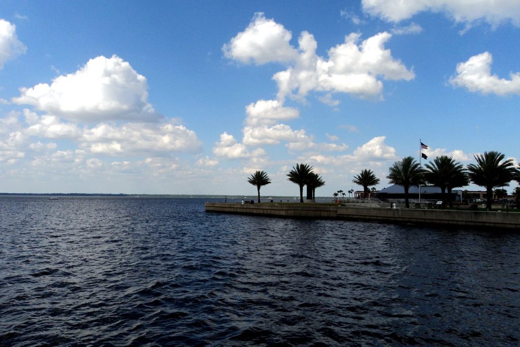
All forecast and warning facts are from the National Weather Service forecast office in Melbourne, checked Saturday evening, Nov. 21, 2026, at about 8:00 p.m. EST: Flood Warnings FL.W.0007 (Above Lake Harney, 1:52 p.m.), FL.W.0010 (Sanford, 1:55 p.m.), FL.W.0009 (DeLand, 1:59 p.m.), FL.W.0003 (Astor, 2:02 p.m.) and FL.W.0006 (Cocoa 9W, 1:48 p.m., scope only), via api.weather.gov active alerts; Orlando gridpoint forecast MLB 26,68 generated 7:10 p.m. EST Saturday (00:10 UTC Nov. 22); Area Forecast Discussion FXUS62 KMLB 212359, discussion and key messages issued 3:01 p.m. EST. Tropical outlook: National Hurricane Center Tropical Weather Outlook, 7:00 p.m. EST Saturday, Nov. 21, 2026, Forecaster Cangialosi. Next river statements are due tonight at 11:00 p.m. EST, and at 11:15 p.m. EST for Above Lake Harney — after this run; Sunday’s 06:00 run owes them. Photo: file photograph of Lake Monroe at Sanford, treated to magazine grade under the site’s fidelity lock, reused from the desk’s earlier St. Johns River coverage; credit as carried on that image.
Orlando Citizen by email
The weekly edition, in your inbox
One email, every Saturday: the week’s edition of Orlando Citizen — the week’s stories, rankings and winners, gathered in one place. Free, and you can unsubscribe at any time.
Related Stories
Editor’s Picks
Spotted an error? Tell us — corrections · How we rank