St. Johns River at Crest Eve: Harney at 11.7 Feet, a 13-Foot Crest Forecast for the Weekend, SR 46 Still Closed
With State Road 46 closed at the river, Seminole County has urged residents of low-lying homes to leave voluntarily while they still can, after the St. Johns above Lake Harney reached 11.7 feet Friday night in major flooding, with a crest of 13.0 feet forecast late this weekend.
3 minute read
SANFORD — For families along Lake Harney Road, the question on Saturday is how long the roads out will stay passable. For Geneva and Sanford drivers who cross the St. Johns River on State Road 46, the crossing is already closed. At 10.8 feet, according to the National Weather Service’s impact table, water covers SR 46 near Jungle Road and Prevatt Road, and standing water on secondary roads near the river deepens past three feet in places. At 8:30 p.m. Friday, the river above Lake Harney stood at 11.7 feet, nearly six feet above bankfull and in major flooding. The Weather Service expects it to keep rising, with a crest of 13.0 feet late this weekend.
The facts up top: The Flood Warning for the St. Johns River above Lake Harney remains in effect until further notice. In its 9:03 p.m. Friday statement, the Weather Service’s Melbourne office reported the 11.7-foot reading from 8:30 p.m. Flood stage is 8.0 feet and bankfull is 6.0 feet. The forecast crest of 13.0 feet late this weekend would exceed the post-Ian high-water mark of 12.67 feet, recorded on October 3, 2022. SR 46 remains closed at the river until further notice. Seminole County’s sandbag site at the Old Geneva Volunteer Fire Station, 217 2nd St. in Geneva, is open from 7 a.m. to 7 p.m.
Who is affected today that was not yesterday
The river has been rising slowly, a tenth of a foot at a time putting water over another stretch of the low roads Seminole County has been closing in sequence. On Friday, the county added Mullet Park Road, Osceola Road, Fort Lane Road and Lake Harney Road to the list of roads already shut near the river. At the current level, the Weather Service says, flooding becomes more significant for structures and marinas from above Lake Harney to the Lake Jesup area. The county has advised residents of low-lying homes along the river to leave voluntarily while the roads out are still passable. Saturday, the last full day before the forecast crest, is a day to move what can still be moved and stay off flooded roads.
The detour reality on SR 46
With SR 46 closed at the river, a routine trip between Geneva and Sanford means a long detour to the south or north. The Citizen’s Traffic desk is following changes in the closure in its Saturday traffic report, which also tracks the SR 520 flooding closure and the Brightline resumption. The Weather desk’s Saturday river record traces each gauge reading to a named Weather Service product. Riverfront and county coverage is gathered on the Sanford hub.
What changes at the crest
If the river reaches 13.0 feet late this weekend, it will have risen above the gauge’s post-Ian mark. The water will take days to recede, falling as slowly as it rose. The county inspects roads before reopening them, and residents should expect closures to last beyond the crest. The next Weather Service statement will update the figures. For Saturday, the latest reading is 11.7 feet and the forecast crest is 13.0 feet. Even after the river stops rising, drivers will still be waiting for the roads to reopen.
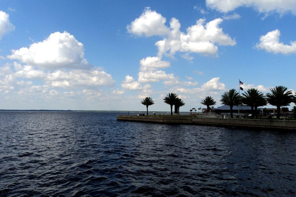
Photo: Lake Monroe at Sanford, on the St. Johns River. File photograph, via the Citizen’s Weather desk coverage.
Sources & notes
National Weather Service, Melbourne office, Flood Statement for the St. Johns River above Lake Harney, issued 9:03 p.m. EST Friday, November 20, 2026 (stage 11.7 ft at 8:30 p.m. Friday; bankfull 6.0 ft; flood stage 8.0 ft; forecast crest 13.0 ft late this weekend; impacts at 10.8 ft as quoted; warning in effect until further notice) — read directly from the NWS product this run, November 21, 2026. The 12.67 ft post-Ian reference (October 3, 2022) and the Seminole County closure list (Mullet Park Rd, Osceola Rd, Fort Lane Rd, Lake Harney Rd) and Geneva sandbag site (Old Geneva Volunteer Fire Station, 217 2nd St., 7 a.m.–7 p.m.) are as recorded in the Citizen SEO lead’s November 21 brief from the county’s Friday products; the crest figure is reported throughout as a forecast, never as an observed level. SR 46 closure status: Florida Department of Transportation / Seminole County, via the Citizen Traffic desk’s Saturday record, linked above.
Orlando Citizen by email
The weekly edition, in your inbox
One email, every Saturday: the week’s edition of Orlando Citizen — the week’s stories, rankings and winners, gathered in one place. Free, and you can unsubscribe at any time.
Related Stories
 NeighborhoodsWinter Park Park Avenue on a Sunday: The Holiday Edition, With the Morse Museum’s Hours
 NeighborhoodsKissimmee Lakefront Park on a Sunday: The Lake Tohopekaliga Shore, Planned From the City’s Own Page
 NeighborhoodsFrontyard Holiday Festival Orlando Opens Friday, November 27: The Final Preview
Editor’s Picks
Spotted an error? Tell us — corrections · How we rank