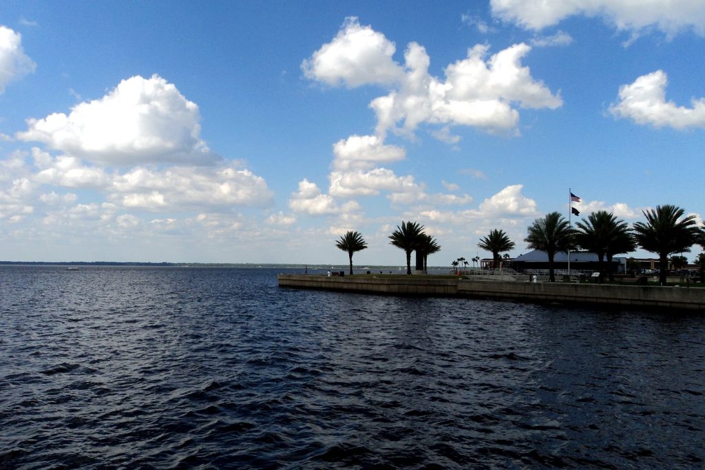
Sanford’s Riverwalk and Lake Monroe: The St. Johns at Street Level
Sanford's Riverwalk runs past a marina still being rebuilt after Hurricane Ian. The walk, the free day slips, and the river's current state, at street level.
3 minute read
The facts first. Sanford’s front porch is a paved Riverwalk along the south shore of Lake Monroe — the wide lake the St. Johns River passes through on its way north — running past Veterans Memorial Park, Fort Mellon Park and the downtown marina, a few blocks from the historic downtown’s galleries, shops, breweries, theatres and eateries. Two current facts shape any visit this month. The marina at its centre is a construction story, not a finished facility: it is still being rebuilt from Hurricane Ian’s September 2022 damage, and the city’s own recovery page, updated October 5, 2026, puts estimated damages at approximately $20 million against $6.4 million in FEMA reimbursement authorised so far. And the river itself is high: flood warnings remain in effect on the St. Johns above and below the lake, as our Weather desk has verified — the subject of this morning’s service piece, Orlando Weather This Week: Rain Tuesday Through Friday, Flood Risk, and the St. Johns River.
The walk itself
The Riverwalk is the city’s default movement: a flat, paved, multi-use trail on East Seminole Boulevard that meanders along both sides of the marina, in the marina operator’s own description, with the downtown grid immediately behind it. Boaters are part of the same picture — the city now offers free day slips along the east side of Veterans Memorial Park, at 110 E. Seminole Boulevard, provided with Florida Department of Environmental Protection and National Park Service support: first-come, first-served, daytime use only, no overnight docking. Dock, and downtown is steps away. For most residents the honest description is simpler than any trail map: this is where Sanford walks its dogs, runs its mornings and watches its weather come across the lake — and this week, with rain forecast Tuesday through Friday, the lake-watching is the show.
The marina: what the rebuild actually involves
Read the city’s recovery page as a resident, and the marina’s state is precise. Ian flooded the Riverwalk and damaged the docks in 2022; the city’s engineers put the damage — dock and piling destruction plus silt pushed into the two basins — at roughly $18–20 million across successive estimates. FEMA’s revised estimate came in at $6.4 million; the city appealed, supplied the maintenance records and assessments FEMA requested on June 29, 2026, and is awaiting the first-appeal decision, with a second appeal or arbitration still open to it. Meanwhile the practical work moves: dredging, revetment and dock design permitting began in October 2025, approximately 26,000 cubic yards of lake bottom are to come out of the east and west basins, and as of October 1, 2026, every permit had been issued except the state dredging permit — with all permits expected by January 2027. Construction starts after permits; the city gives no construction duration, and neither do we.
The river, stated as verified
Lake Monroe is the St. Johns at street level, so the river’s condition is this walk’s condition. As the Weather desk’s verified record stands — and as this morning’s news piece reported from NWS Melbourne’s products — the St. Johns stood at 9.0 feet near Above Lake Harney, upstream of the lake, at moderate flood stage, and at 2.6 feet at Astor, downstream, at minor flood stage, with flood warnings in effect until further notice. That is the whole claim: a high river, a lakefront built to be walked, and a marina whose full return is a 2027 permitting story before it is a construction one. For Sanford after dark rather than at the water’s edge, our guide to the Asian Lantern Festival at the Central Florida Zoo — Sanford’s other November draw, across town — is the companion piece.
Sources & notes
Marina damage estimates, the FEMA $6.4 million authorisation and appeal status, the June 29, 2026 information submission, the dredging volume (approximately 26,000 cubic yards), the permit status as of October 1, 2026 and the January 2027 expectation, and the free day slips at 110 E. Seminole Boulevard (first-come, daytime only, no overnight docking, FDEP/NPS support) all checked against the City of Sanford’s own marina and recovery page, read this run (city update dated October 5, 2026). The Riverwalk’s course past the marina and its relation to historic downtown are from the Downtown Sanford Marina’s own site and the city’s page. River stages and warning status are stated exactly as this paper’s Weather desk verified them from NWS Melbourne products and as reported in this morning’s linked news piece — this article issues no warning of its own. No trail length is asserted: published figures for the Riverwalk’s length vary by segment, and the article describes the route by its landmarks instead. Featured image: file photograph of Lake Monroe at Sanford shared with our Weather desk coverage (Gabriel Vanslette, CC BY, via Wikimedia Commons), captioned as a file photo.
Orlando Citizen by email
The weekly edition, in your inbox
One email, every Saturday: the week’s edition of Orlando Citizen — the week’s stories, rankings and winners, gathered in one place. Free, and you can unsubscribe at any time.
Related Stories


Editor’s Picks
Spotted an error? Tell us — corrections · How we rank