St. Johns River Crest Today: Harney at 12.5 Feet, a 13-Foot Crest Arriving, and the Flood’s Move Toward Sanford
As the St. Johns River above Lake Harney stands at 12.5 feet with a 13.0-foot crest forecast this weekend, a week of upstream water is already shifting downstream toward Sanford, where the river reached 7.1 feet Saturday night and is projected to climb to 8.2 feet late next week.
4 minute read
SANFORD — For the people who live along the St. Johns River, crest day arrives without rain. The rain is already behind Central Florida; what reaches them today is the water itself, gathered from a week of rain upstream and moving at the pace of a river that falls about an inch a mile. Above Lake Harney, near Geneva, the gauge stood at 12.5 feet at 7:30 p.m. Saturday — in major flooding, more than double bankfull — and the National Weather Service forecasts a crest of 13.0 feet this weekend. If that forecast verifies, it will pass the gauge’s post-Ian mark of 12.67 feet from October 2022. Downstream, that same water is now Sanford’s problem, and it will remain one for days after Harney turns.
The Flood Warning for the St. Johns River above Lake Harney remains in effect until further notice, according to an 8:27 p.m. Saturday statement from the National Weather Service office in Melbourne. At that gauge, where bankfull is 6.0 feet and flood stage is 8.0 feet, the 12.5-foot reading at 7:30 p.m. Saturday leaves the projected 13.0-foot weekend crest a forecast, not an observed level. Downriver at Sanford, the river stood at 7.1 feet at 7:30 p.m. Saturday, in moderate flooding, and is forecast to keep rising to 8.2 feet late next week, reaching major flood stage by the middle of the week. Volusia County is opening a new self-service sandbag site today at Ed Stone Park in DeLand, and the next Weather Service statement is due Sunday at noon.
Who is affected today that was not yesterday
The shift downstream is what changes today. On Lake Monroe, the Sanford gauge has already crossed 7.0 feet — the point in the Weather Service’s impact table at which water begins to move over the seawall around Lake Monroe and encroach on Seminole Boulevard. At 7.4 feet, many secondary roads around the lake may become impassable. At 8.0 feet, the level forecast for later this week, flooding becomes more significant to low-lying structures and marinas in Sanford, Enterprise and around Lake Monroe. A household along the Geneva roads woke today to a crest; a household on the Sanford waterfront wakes to a week of rising water, with its preparation window open now, while the river is still a foot below major stage there.
The sandbag line, and the roads
At 10 a.m. today, Volusia County opens its new sandbag site at Ed Stone Park, 2990 W. State Road 44 in DeLand, operating until 5 p.m. today and then from 8 a.m. to 5 p.m. daily until further notice, according to the county’s Saturday release as reported this morning. Bags and sand are provided, and residents should bring a shovel and gloves; the county’s Osteen site at Fire Rescue Station 36 also continues. On the roads, State Road 46 remains closed at the river — water covers it at 10.8 feet on the Harney gauge, a level passed days ago — and the Citizen’s Traffic desk is carrying a separate SR 50 flooding closure record this morning. Every gauge traced to its named Weather Service product appears in the Weather desk’s Sunday river record; this account repeats none of that record, carrying only what crest day changes for the people downstream. Riverfront coverage gathers on the Sanford hub.
What the crest does not end
On the St. Johns, a crest at Harney is a beginning downstream, not an ending anywhere. The river falls as slowly as it rose, roads reopen on inspection rather than on the gauge alone, and Sanford’s forecast crest remains days away, with the Weather Service stating that additional rises are possible thereafter. That leaves the day defined by two numbers moving in opposite directions: 13.0 feet forecast at the top of the system, and 7.1 feet, rising, at the city that receives it next.
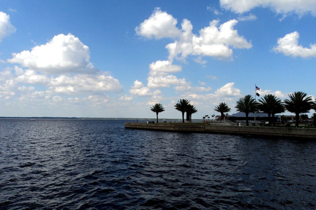
Photo: Lake Monroe at Sanford, on the St. Johns River. File photograph, via the Citizen’s Weather desk coverage.
Sources & notes
National Weather Service, Melbourne office, Flood Statements issued 8:27 p.m. EST (Above Lake Harney: 12.5 ft at 7:30 p.m. Saturday; bankfull 6.0 ft; flood stage 8.0 ft; forecast crest 13.0 ft this weekend; water covers SR 46 at 10.8 ft; next statement Sunday noon) and 8:30 p.m. EST (Sanford: 7.1 ft at 7:30 p.m. Saturday; bankfull 4.2 ft; flood stage 5.5 ft; forecast steady rise to 8.2 ft late next week, major flooding by midweek, additional rises possible; impacts at 8.0 ft as stated) Saturday, November 21, 2026 — read directly from the NWS products this run. Sanford impact thresholds at 7.0 ft (seawall / Seminole Boulevard) and 7.4 ft (secondary roads): NWS impact table for the Sanford gauge, via the gauge’s published impact statements. Post-Ian reference 12.67 ft (October 2022): NWS / Citizen Weather desk record. Ed Stone Park sandbag site (2990 W. SR 44, DeLand; 10 a.m.–5 p.m. today, then 8 a.m.–5 p.m. daily until further notice; bags and sand provided, bring shovel and gloves; Osteen Station 36 continuing): Volusia County Saturday release, as reported Sunday morning by county-news reporting checked this run. The crest figure is reported throughout as a forecast, never as an observed level.
Orlando Citizen by email
The weekly edition, in your inbox
One email, every Saturday: the week’s edition of Orlando Citizen — the week’s stories, rankings and winners, gathered in one place. Free, and you can unsubscribe at any time.
Related Stories

Editor’s Picks
Spotted an error? Tell us — corrections · How we rank