Sanford RiverWalk on a Flood Sunday: The 4.5-Mile Lake Monroe Trail, Planned Honestly
With the St. Johns River in moderate flood at 7.1 feet and water moving over Lake Monroe's seawall, a Sunday along Sanford's 4.5-mile RiverWalk calls for a plan shaped by the high water, not the usual routine.
3 minute read
SANFORD — Most Sundays in Seminole County require little calculation: leave the car near the marina, walk west along Lake Monroe and finish in a downtown that has spent a decade becoming a destination. This Sunday asks for a different habit of mind. The lake bordering the Sanford RiverWalk is the St. Johns River in moderate flood — 7.1 feet at the Sanford gauge on Saturday evening, past the point where water moves over the seawall and begins to encroach on Seminole Boulevard. Any honest plan starts with that water, not the scenery. The trail is still worth planning around, just not blindly.
The RiverWalk is a paved multi-use trail of about 4.5 miles along the Lake Monroe shoreline, running from E. Seminole Boulevard at N. Mellonville Avenue west to Lake Monroe Wayside Park (4150 Hwy 17), where it connects with the Cross Seminole Trail and the Spring to Spring Trail. It passes Fort Mellon Park, Veterans Memorial Park, the Sanford Marina and the Sanford Museum, with historic downtown a few blocks south. At 7:30 p.m. Saturday, however, the National Weather Service in Melbourne recorded the St. Johns near Sanford at 7.1 feet, in moderate flooding, forecast to rise to 8.2 feet late next week.
The flood-honest version of the walk
Today, the Weather Service’s impact table for the Sanford gauge is the essential map. At 7.0 feet, water begins to move over the seawall around Lake Monroe, rising into the grassy areas beside it and encroaching on Seminole Boulevard; at 7.4 feet, many secondary roads around the lake may become impassable. With the gauge past 7.0 on Saturday, the honest Sunday plan centers on the downtown end of the corridor — the parks, the museum blocks and First Street — reached by road. Any lakeside stretch is conditional: if it is wet, closed or posted, it is not today’s walk, and no flooded road or trail segment gets crossed to reach it. The full downstream forecast behind that plan appears in the Citizen’s crest-day report, St. Johns River Crest Today.
The trail itself, for the Sundays after this one
The high water will pass; the corridor along the shore took decades to assemble. The City of Sanford’s own RiverWalk history explains why the trail feels finished in a way older paths do not: conceived as a lakeside sidewalk in 1995, it was built in three phases — 1.2 miles from Mellonville Avenue to French Avenue in 2004, an extension to Mangoustine Avenue in 2018 and a final roughly 3.4-mile phase tying it into the 210-mile Florida Coast-to-Coast trail and completing the 26-mile loop around Lake Monroe. That network is why the RiverWalk rewards planning rather than just a stroll: ride west and you are on a cross-state trail; walk east and you are in downtown. Sanford coverage gathers on the Sanford hub. The river will fall slowly over the coming weeks, leaving all 4.5 miles waiting; today’s version is simply written for the water that is actually there.
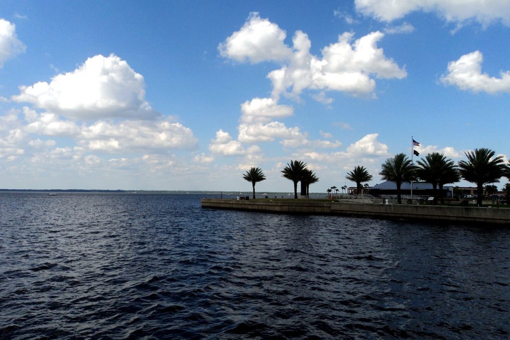
Photo: Lake Monroe at Sanford. File photograph, via the Citizen’s river coverage.
Sources & notes
Trail facts (about 4.5 miles; Mellonville Avenue to Lake Monroe Wayside Park, 4150 Hwy 17; connections to the Cross Seminole Trail and Spring to Spring Trail; Fort Mellon Park, Veterans Memorial Park, Sanford Marina, Sanford Museum and downtown access): TrailLink / Rails to Trails Conservancy trail record, checked this run. Build history (1995 conception; Phase I 2004, 1.2 miles Mellonville–French; Phase II to Mangoustine Avenue 2018; final phase about 3.4 miles, Coast-to-Coast connection and the 26-mile Lake Monroe loop): City of Sanford RiverWalk page, sanfordfl.gov, checked this run. Flood facts (Sanford gauge 7.1 ft at 7:30 p.m. Saturday, moderate flooding, forecast 8.2 ft late next week; impacts at 7.0 ft and 7.4 ft as stated): National Weather Service Melbourne Flood Statement, 8:30 p.m. EST Saturday, November 21, 2026, and the gauge’s NWS impact table. No segment of the trail is asserted to be open or closed today beyond the impact-table facts stated; conditions are directed to the city’s and the Weather Service’s current notices, as the body states.
Orlando Citizen by email
The weekly edition, in your inbox
One email, every Saturday: the week’s edition of Orlando Citizen — the week’s stories, rankings and winners, gathered in one place. Free, and you can unsubscribe at any time.
Related Stories

Editor’s Picks
Spotted an error? Tell us — corrections · How we rank
