Orlando Weather Today, Sunday: Harney at 12.5 Feet, Crest of 13.0 Feet Forecast This Weekend
While Orlando catches a dry, 75-degree reprieve on Sunday, families along the St. Johns River face water still climbing toward record levels, with the gauge above Lake Harney at 12.5 feet, a 13.0-foot crest forecast this weekend and all four warnings still in effect.
5 minute read
For the families along State Road 46 near Geneva, Sunday morning splits the region in two: a dry, partly sunny day over Orlando, and a river still rising toward the highest water it has ever carried. The St. Johns River above Lake Harney stood at 12.5 feet on Saturday evening, in major flooding, with a crest of 13.0 feet forecast this weekend. All four of the Citizen’s river warnings remain in effect until further notice.
ORLANDO — For most Orlando residents, Sunday’s choices are simple: the city has no active watches or warnings from the National Weather Service in Melbourne, and the forecast is dry. An hour northeast, along the St. Johns River in Seminole and Lake counties, the choices are far harder. There, the water that fell as rain all last week is still working its way through the basin — pushing the river at the Geneva gauge above Lake Harney toward the flood of record, and putting roads, marinas and low-lying homes at risk across four warning zones.
The river, point by point
Above Lake Harney, near Geneva (Seminole County) — major flooding occurring. By 7:30 p.m. Saturday, the river had climbed to 12.5 feet, up from 12.3 feet at midday Saturday — well past its 6.0-foot bankfull stage and its 8.0-foot flood stage. The Weather Service forecasts a crest of 13.0 feet this weekend, a level it says approaches the flood of record, followed by a slow and steady decline. The water already sits well above 10.8 feet — the mark at which, the statement says, water covers State Road 46 and it may become impassable near Jungle Road and Prevatt Road; standing water on secondary roads near the river deepens to more than three feet in some areas; and flooding becomes more significant to structures and marinas from above Lake Harney to the Lake Jesup area. The next statement is due Sunday at noon.
Near Astor (Lake and Volusia counties) — major flooding occurring. At 7:30 p.m. Saturday, the stage stood at 4.1 feet, against a flood stage of 2.3 feet, with a gradual rise through major flood stage forecast to reach 4.3 feet into the middle of next week. The Weather Service now lists impacts at the 4.5-foot level — a higher list than Saturday’s statements carried. At that mark, the agency says, major widespread and long-duration flooding occurs, with water rescues and evacuations necessary; most low-lying homes become uninhabitable with 2 to 3 feet of water in many areas near the river; water reaches Front Street south of State Road 40; areas off Riveredge Drive are inaccessible; and water surrounds and enters homes on Riverview Drive and Claire Street.
Near Sanford (Seminole County) — moderate flooding occurring, major flooding forecast. The river reached 7.1 feet at 7:30 p.m. Saturday, edging up from 7.0 feet at midday against a 5.5-foot flood stage. A steady rise is expected to carry the gauge to 8.2 feet late next week — past the 8.0-foot level at which flooding becomes more significant to low-lying structures and marinas along the river in Volusia and Seminole counties, including Sanford, Enterprise and Lake Monroe.
Near DeLand (Lake and Volusia counties) — moderate flooding occurring, major flooding forecast. The gauge stood at 5.2 feet at 7:30 p.m. Saturday, above its 4.0-foot flood stage and a tenth of a foot below the 5.3-foot level at which major flooding occurs to many structures and marinas along the river and in the Hontoon Island area. Forecasters expect the river to rise into major flood stage early next week, reaching 6.0 feet mid week.
Every statement repeats the same official guidance, carried here as issued: turn around, don’t drown when encountering flooded roads — most flood deaths occur in vehicles; motorists should not attempt to drive around barricades or drive cars through flooded areas; and caution is urged when walking near riverbanks.
Orlando’s own forecast: a dry Sunday
In Orlando itself, Sunday offers the break the region has been waiting for: partly sunny skies, a high near 75, a rain chance of just 2 percent, and west winds of 5 to 15 mph gusting to 25. Tonight turns mostly cloudy with a low around 60. Monday stays partly sunny near 74, and Tuesday climbs to 77 under mostly cloudy skies.
That dry stretch will not hold all week. Rain chances return Tuesday night at about 30 percent and peak Wednesday, when the forecast carries a 50 percent chance of showers and thunderstorms and a high near 75 before easing Wednesday night. Thanksgiving Day is partly sunny near 72 with a rain chance of only 4 percent, Friday is partly sunny near 69, and next Saturday brings a slight chance of showers near 70.
In its 2:30 a.m. Sunday discussion, the Melbourne office is plain about why Wednesday matters. Dry conditions are forecast through Monday, the office notes, before the next disturbance brings rain chances back Tuesday night into Wednesday — and, given the ongoing flooding and saturated soils, additional flooding will be a concern. The discussion’s hydrology section points out that all five St. Johns River points it watches are either in major flood stage or forecast to reach it, and that any additional rainfall across the basin may lead to additional rises. The discussion expects Wednesday’s rain to move through faster than last week’s system. Whether it still adds measurably to a river already near its record is the open question the noon statements — and the 1 p.m. update — will begin to answer.
Scope notes
A fifth St. Johns warning, for the river near Cocoa in Brevard County, remains in effect outside this desk’s coverage counties; the stage there was 18.8 feet on Saturday evening and is forecast to remain steady in major flood stage. Meanwhile, the National Hurricane Center’s 1:00 a.m. Sunday outlook is unchanged from Saturday evening: development of the offshore Southeast U.S. low into a tropical or subtropical system is no longer expected, with formation chances near 0 percent through both 48 hours and 7 days. No tropical watch or warning is in effect for any coverage county, and the Rip Current Statement on the coast touches no coverage county.
More from the Weather archive and the beats index. The river warnings center on Seminole County — see the Sanford area hub. Related coverage: Saturday evening: Sanford in moderate flooding, Harney at 12.3 feet and Saturday midday: Astor in major flooding, Harney at 12.2 feet.
Sources & notes
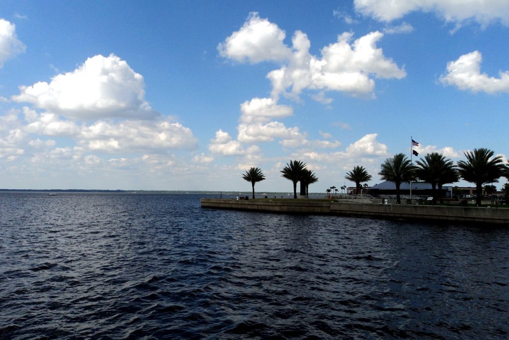
All forecast and warning facts are from the National Weather Service forecast office in Melbourne, read Sunday morning, Nov. 22, 2026: Flood Warnings issued Saturday evening, Nov. 21 — Above Lake Harney near Geneva (8:27 p.m. EST), Astor (8:21 p.m.), Sanford (8:30 p.m.) and DeLand (8:36 p.m.), each in effect until further notice with the next statement due Sunday at noon EST; the Orlando forecast from the Melbourne gridpoint forecast for Orlando (MLB 26,68), generated 5:19 a.m. EST Sunday; the Area Forecast Discussion issued 2:30 a.m. EST Sunday (FXUS62 KMLB 220730); and active-alerts checks showing no alerts for the Orlando point and no watch or warning for Orange or Osceola counties. Tropical information: National Hurricane Center Tropical Weather Outlook, 1:00 a.m. EST Sunday, Nov. 22 (ABNT20 KNHC 220501, Forecaster Cangialosi). River stages are as observed at the times stated in each product; forecast crests are forecasts, not observations. Photo: Lake Monroe at Sanford — Gabriel Vanslette, CC BY, via Wikimedia Commons (the desk’s treated file photograph, reused from Saturday’s coverage).
Orlando Citizen by email
The weekly edition, in your inbox
One email, every Saturday: the week’s edition of Orlando Citizen — the week’s stories, rankings and winners, gathered in one place. Free, and you can unsubscribe at any time.
Related Stories
Editor’s Picks
Spotted an error? Tell us — corrections · How we rank