St. Johns River at Record Flood: What Thursday Means for Sanford, Geneva and the River Roads
In Sanford the St. Johns is rising by inches on a published schedule, after it passed its flood of record near Cocoa overnight, and the river above Lake Harney is forecast to reach major flood stage by Friday morning.
5 minute read
SANFORD — On the river side of Sanford, in the Stone Island and Still Brook subdivisions, Thursday’s threat is measured to the tenth of a foot. The National Weather Service’s impact table says that when the St. Johns River gauge at Sanford reaches 6.2 feet, water completely surrounds many homes there, pool enclosures and patios flood, and water covers many roads. On Wednesday evening the river stood at 5.6 feet, a tenth of a foot above flood stage. The Weather Service expects it to keep climbing slowly, to 6.3 feet by Monday evening. Thursday begins with a forecast rather than a siren. No one in Sanford is being told that the water arrives today. They are being told exactly how much river is coming, and when.
Upstream, the river has already gone past anything on record. Overnight, the St. Johns near Cocoa passed its flood of record. The Weather Service’s Thursday morning update put the gauge at 18.0 feet at 5:15 a.m., against a flood stage of 16 feet, and forecast further rises above record levels through late week and into the weekend. Above Lake Harney, on Seminole County’s eastern edge, the river stood at 9.4 feet at 12:30 a.m. It is forecast to reach major flood stage Thursday overnight into Friday morning and to crest at 10.4 feet early Sunday. At Astor, moderate flooding is no longer just a forecast. It is happening now. A Flood Watch covers the region through 7 p.m. Friday, and Orlando’s forecast for Thursday carries a 90 percent chance of rain, with 1 to 2 inches of new rainfall possible.
What changed overnight
Between Wednesday evening and Thursday morning, three of the river’s gauges crossed into new flood categories. At Cocoa, the flood warning issued at 3:44 a.m. Thursday says it plainly in its WHAT line: “Major flooding is occurring and major flooding is forecast. This passes the flood of record.” The gauge read 17.7 feet at 3:15 a.m. The service says that at 17.2 feet, water enters homes along the river in the Lake Poinsett area west of Cocoa and low-lying homes in Rockledge’s Silver Pines subdivision, and the Providence Road area west of Cocoa becomes impassable. The warning forecast a crest of 18.0 feet on Thursday afternoon. The service’s later morning update recorded the river at that level at 5:15 a.m.
At Astor, the change came down to a single verb. Wednesday afternoon’s statement said minor flooding was occurring. Wednesday evening’s statement was the first to report moderate flooding. Thursday’s statement, issued at 3:54 a.m., confirmed it at 3.1 feet, against a flood stage of 2.3 feet, and forecast a rise to 3.7 feet by early Monday morning. For the 3.5-foot level, the service’s impact table lists canals overflowing into yards, homes on or near Wildhog, Bonnet and Snail roads becoming inaccessible, and the docks at the Astor Bridge marina completely submerged.
The Harney reach: Geneva and the SR 46 corridor
For Seminole County, the gauge that matters most is the one above Lake Harney, which serves the Geneva side of the county. The warning there remains in effect until further notice: moderate flooding is occurring, and major flooding is forecast. The forecast crest, 10.4 feet early Sunday morning, is just below 10.5 feet. At that level, the service’s impact table says, water covers many secondary roads near the river, so homes can be reached only by boat or high-terrain vehicle, and it begins to encroach on State Road 46 near Jungle Road and Prevatt Road. So the next three days on the river roads come down to a single margin. The forecast crest sits one-tenth of a foot below the level at which the impact table names the state road itself, and the river could rise further after the crest. The next Harney statement is due Thursday at 11 a.m.
Sanford and DeLand: the slow climb
Sanford’s warning, in a statement issued at 8:12 p.m. Wednesday, reports that minor flooding is occurring and forecast to continue. The river is expected to reach 6.3 feet Monday evening, and it could rise further after that. Downstream, DeLand crossed its own flood stage on Wednesday evening. Its statement, issued at 8:15 p.m. Wednesday, reports minor flooding at 4.1 feet, against a flood stage of 4.0 feet, and forecasts a rise to 4.7 feet by Monday morning. At 4.8 feet, water starts to enter low-lying buildings around Hontoon Island. The next statements for both points are due Thursday at 11 a.m.
The Citizen’s Weather desk is updating the forecast record as the Weather Service revises it. Its Thursday morning report traces every gauge reading to a named Weather Service product, and Wednesday’s resident guide to the Flood Watch explains what the watch means street by street. Riverfront coverage is gathered on the Sanford hub, and the Riverwalk and Lake Monroe guide is the standing record of the waterfront the river is now pressing against. The St. Johns will not crest in Sanford this week. It will rise by inches, on a published schedule, and residents can plan around that schedule.
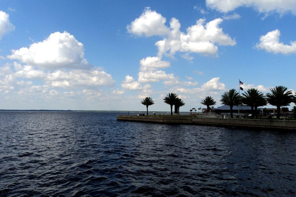
Photo: Lake Monroe at Sanford, on the St. Johns River in Seminole County. Photo: Gabriel Vanslette, CC BY, via Wikimedia Commons (file photograph, via the Citizen’s Weather desk coverage).
Sources & notes
National Weather Service, Melbourne office, as traced in the Citizen Weather desk’s Thursday report (checked November 19, 2026): Flood Warning for the St. Johns River near Cocoa, issued 3:44 a.m. EST Thu Nov. 19 (17.7 ft at 3:15 a.m.; flood stage 16.0 ft; crest of 18.0 ft forecast Thursday afternoon; 17.2-ft impacts as quoted), and the service’s Thursday morning update recording 18.0 ft at 5:15 a.m. above the flood of record, as traced by the Citizen’s SEO lead from the same product line. Flood Statement for Above Lake Harney, 1:39 a.m. EST Thu Nov. 19 (9.4 ft at 12:30 a.m.; flood stage 8.0 ft; major flooding forecast Thu overnight–Fri; crest 10.4 ft early Sunday; 10.5-ft impacts as quoted). Flood Statement for Astor, 3:54 a.m. EST Thu Nov. 19 (3.1 ft at 3:30 a.m.; flood stage 2.3 ft; moderate flooding occurring; 3.7 ft forecast early Monday; 3.5-ft impacts as quoted). Flood Statements for Sanford (8:12 p.m. EST Wed Nov. 18: 5.6 ft at 7:30 p.m.; flood stage 5.5 ft; 6.3 ft forecast Monday evening; 6.2-ft impacts as quoted) and DeLand (8:15 p.m. EST Wed Nov. 18: 4.1 ft; flood stage 4.0 ft; 4.7 ft forecast Monday morning). Flood Watch FA.A.0004, in effect through 7:00 p.m. EST Fri Nov. 20; Orlando Thursday forecast (90 percent precipitation chance, 1 to 2 inches of new rainfall) from the NWS Melbourne gridpoint forecast generated 5:19 a.m. EST Thu Nov. 19. No road closure or local impact beyond the Weather Service’s published impact tables is asserted; none had been officially reported at filing.
Orlando Citizen by email
The weekly edition, in your inbox
One email, every Saturday: the week’s edition of Orlando Citizen — the week’s stories, rankings and winners, gathered in one place. Free, and you can unsubscribe at any time.
Related Stories



Editor’s Picks
Spotted an error? Tell us — corrections · How we rank
