Orlando Weather Today, Wednesday: Flood Watch Through Friday, Harney Back in Moderate Flooding at 9.0 Feet
As heavy rain arrives in Orlando under a Flood Watch through Friday and the St. Johns River holds in moderate flooding at 9.0 feet Above Lake Harney, residents downstream in Astor face a 3.4-foot Sunday forecast just one-tenth of a foot shy of flooded yards, submerged docks and water inside homes.
11 minute read
Weather desk — morning report, Wednesday, Nov. 18, 2026. Storm mode: a Flood Watch and two St. Johns River Flood Warnings are in effect for the Citizen’s coverage counties.
Along Wildhog, Bonnet and Snail roads in Astor, on the Lake County bank of the St. Johns River, the margin separating minor high water from inundated homes this week is one-tenth of a foot. At 3.5 feet, according to the National Weather Service in Melbourne, the river overflows canals into yards, completely submerges the docks at the Astor Bridge marina and leaves homes on or near those roads inaccessible, with several inches of water inside. None of that is happening this Wednesday morning: minor flooding is occurring at Astor, where the river stood at 2.7 feet on Tuesday evening, and the rise into moderate flooding — projected to reach 3.4 feet by Sunday morning — remains a forecast. Yet Wednesday is the day the rain driving that projection arrives in earnest over Orlando, bringing showers and thunderstorms, a high near 71 and a 90 percent chance of precipitation across a region already under a Flood Watch, above a river system with no room left in it. Upstream in Seminole County, Above Lake Harney, the St. Johns is back in moderate flooding at 9.0 feet, where it has held since the weekend.
The morning facts. A Flood Watch remains in effect through 7 p.m. Friday for Orange, Seminole and Osceola counties, while Lake County is not in the watch. In Orlando today, showers and thunderstorms will bring a high near 71, a 90 percent chance of precipitation and between three quarters and one inch of possible new rainfall; tonight carries a low around 66, a 90 percent chance of precipitation and 1 to 2 inches of possible new rainfall. On the St. Johns River near Above Lake Harney, moderate flooding is occurring above an 8.0-foot flood stage, with the gauge at 9.0 feet at 7:30 p.m. Tuesday and forecast to remain steady above flood stage at 9.0 feet. Near Astor, where flood stage is 2.3 feet, minor flooding is occurring at 2.7 feet as of 7:30 p.m. Tuesday, with moderate flooding forecast and the river expected to rise to 3.4 feet Sunday morning. The next river statements are due this morning at 11 a.m., and today’s 13:00 report will lead with them.
The Flood Watch: in effect through Friday evening
Across most of east central Florida — including Orange, Seminole and Osceola counties within this desk’s coverage area — a Flood Watch issued by the National Weather Service in Melbourne at 3:18 p.m. Monday (WGUS62 KMLB 162018) runs from Tuesday afternoon through Friday evening, expiring at 7 p.m. Friday, Nov. 20. Forecasters call for repeated rounds of showers and isolated storms through Friday, bringing 3 to 6 inches of rain and localized higher totals of 8 to 12 inches, with the greatest potential for those heavier amounts over the coastal counties. Flooding caused by excessive rainfall is possible, as excessive runoff may result in flooding of rivers, creeks, streams and other low-lying and flood-prone locations.
For those living in areas prone to flooding, the watch’s standing guidance is unchanged: monitor later forecasts, remain alert for possible Flood Warnings and be prepared to take action should flooding develop. Coverage across the Citizen’s desks is indexed on the beats index.
Lake County remains outside the watch, and this morning’s forecast discussion, issued at 1:43 a.m. Wednesday, repeats why: forecasters continue to leave Lake County out of the Flood Watch because of less soil saturation and a better ability to absorb several inches over a few days. Even so, Lake County is not beyond the week’s flooding — on its eastern border, Astor sits under the Flood Warning detailed below.
What changed overnight
The river statements this desk had been awaiting for 11 p.m. Tuesday arrived early again, at 8:15 and 8:20 p.m. Tuesday, mere minutes after Tuesday evening’s report had been filed from the morning bulletins. Carried here for the first time, they restore a consequential phrase at Above Lake Harney. Where Tuesday morning’s statement reported minor flooding occurring and moderate flooding forecast, Tuesday evening’s statement returned to the wording of Monday evening’s bulletin: moderate flooding occurring and moderate flooding forecast. The water level itself has not budged, standing at 9.0 feet Tuesday evening just as it has since Saturday. Yet the evening statement’s preamble notes that river levels are expected to slowly rise into this weekend through Moderate Flood Stage due to additional heavy rainfall over the basin — even while its own forecast line holds the river steady above flood stage at 9.0 feet. Both are the statement’s words, carried here just as the bulletin carries them.
Overnight, the rain forecast rose as well. Measured against the forecast generation in Tuesday evening’s report, today’s chance of precipitation climbed from 80 to 90 percent, with three quarters to one inch of new rainfall possible, and tonight’s climbed to 90 percent with 1 to 2 inches possible. After collaborating with the Weather Prediction Center, forecasters also elevated the risk framing in their overnight discussion, placing portions of the east-central Florida Atlantic coast under a Moderate risk (Level 3 out of 4) of excessive rainfall for the next three days, today through Friday, with a Slight risk (Level 2 out of 4) across much of the interior. Kept distinct here from the watch’s 3-to-6-inch figures rather than merged with them, the discussion’s rainfall totals call for widespread amounts of 4 to 6 inches, locally 8 to 12 inches closer to the coast, and a small chance of highly localized amounts above 12 inches focused primarily over portions of Volusia and Brevard counties. Its warning to motorists is plain: do not drive through flooded roadways if you encounter flooding. Downstream, the discussion’s hydrology section notes that the DeLand and Sanford points on the St. Johns — Sanford’s riverfront sits on the southern shore of Lake Monroe, downstream of the Harney reach — are forecast to hold in Action Stage in the near term before reaching Minor Flood Stage as this week’s additional rainfall pushes river levels higher. That remains a forecast rather than an observation, and no warning covers DeLand or Sanford this morning.
The river this morning
Above Lake Harney, Seminole County. Under a Flood Warning that remains in effect until further notice (Flood Statement 8:15 p.m. Tuesday, WGUS82 KMLB 180115), moderate flooding is occurring and moderate flooding is forecast. At 7:30 p.m. Tuesday, the river stood at 9.0 feet — also its 24-hour maximum, above a 6.0-foot bankfull stage and an 8.0-foot flood stage — and is expected to remain steady above flood stage at 9.0 feet. At 9.3 feet, the statement’s next listed threshold, water floods many secondary roads near Lake Harney and brings flooding to the Hatbill Road area near Loughman Lake. The next statement is due at 11 a.m. this morning.
Astor, Lake and Volusia counties. Farther north in Astor, a Lake County river community, the Flood Warning likewise remains in effect until further notice (Flood Statement 8:20 p.m. Tuesday, WGUS82 KMLB 180120), with minor flooding occurring and moderate flooding forecast. The gauge stood at 2.7 feet at 7:30 p.m. Tuesday — matching its 24-hour maximum, above a 2.0-foot bankfull stage and a 2.3-foot flood stage — and is expected to reach 3.4 feet Sunday morning, with additional rises possible thereafter. Through at least midweek, the statement’s preamble attributes the pattern to slight rises within Minor Flood Stage, pushed by northerly winds and water from upstream heavy rainfall working north through the basin, before additional expected downpours drive the river into Moderate Flood Stage later in the week. Just above Sunday’s forecast, at the 3.5-foot level, the statement details the stakes along the water: canals overflowed into yards; homes on or near Wildhog, Bonnet and Snail roads rendered inaccessible, with several inches of water inside homes along the river and canals; docks at the Astor Bridge marina and throughout Astor completely submerged; Bartram Road, Holiday Circle and Clair Street made inaccessible; roads flooded in South Moon Fish Camp; and water breaching the sea wall at Blair’s Jungle Den. Its next statement is also due this morning at 11 a.m.
Both bulletins close with identical safety guidance: motorists should not attempt to drive around barricades or drive cars through flooded areas, and caution is urged when walking near riverbanks.
Orlando weather today and the week ahead
For anyone in Orlando asking “is it going to rain in Orlando today,” the answer is yes — showers and thunderstorms are the forecast itself, not merely a chance of them. Here is how the National Weather Service in Melbourne frames the days ahead (gridpoint MLB 26,68, generated at 2:34 a.m. Wednesday):
- Today, Wednesday, Nov. 18: Rain showers likely before 10 a.m., then showers and thunderstorms; mostly cloudy, with a high near 71, an east-northeast wind around 15 mph and gusts as high as 30 mph; chance of precipitation 90 percent, with new rainfall between three quarters and one inch possible. Tonight brings showers and thunderstorms, a low around 66, a 90 percent chance of precipitation and new rainfall between 1 and 2 inches possible.
- Thursday, Nov. 19: Showers and thunderstorms before 1 p.m., then a chance of showers and thunderstorms; partly sunny, high near 75, chance of precipitation 80 percent, with gusts as high as 30 mph. Thursday night carries a chance of showers and thunderstorms, a low around 68 and a 50 percent chance of precipitation.
- Friday, Nov. 20: Rain showers likely, then showers and thunderstorms likely; mostly cloudy, high near 76, chance of precipitation 70 percent. The Flood Watch ends at 7 p.m. Friday. Friday night brings showers and thunderstorms likely, then a chance of showers and thunderstorms, with a low around 67 and a 70 percent chance of precipitation.
- Saturday, Nov. 21: Partly sunny with a chance of rain showers, high near 78, chance of precipitation 30 percent. Saturday night brings a chance of rain showers before 7 p.m., then partly cloudy skies, a low around 64 and a 30 percent chance of precipitation.
- Sunday, Nov. 22: Mostly sunny, high near 78, chance of precipitation 12 percent — sunshine returning overhead on the morning the St. Johns at Astor is forecast to reach 3.4 feet. Sunday night turns partly cloudy, with a low around 61.
- Monday, Nov. 23: Mostly sunny, high near 77, chance of precipitation 5 percent. Monday night is partly cloudy, with a low around 62.
- Tuesday, Nov. 24: Mostly sunny, then a slight chance of rain showers after 1 p.m., high near 78, chance of precipitation 18 percent.
Two boundary notes define the wider map beyond this desk’s four inland coverage counties. Along the coast only, a High Surf Advisory reissued at 1:25 a.m. Wednesday runs through 7 p.m. Friday for coastal Volusia, Brevard, Indian River, St. Lucie and Martin counties, bringing dangerous rip currents and large breaking waves of 5 to 10 feet in the surf zone while touching none of the inland coverage area. Farther upstream on the St. Johns near Cocoa in Brevard County — outside this desk’s coverage counties, though named here so readers tracking the whole river can see the full warning set — a third Flood Warning remains in effect with major flooding occurring and forecast: 17.1 feet at 7:15 p.m. Tuesday, forecast to remain steady above flood stage at 17.1 feet, with impacts listed at the 17.2-foot level. Elsewhere, the National Hurricane Center’s 1 a.m. outlook reports that tropical cyclone formation is not expected during the next seven days, and no heat advisory is in effect. Earlier in this sequence, Tuesday afternoon’s update carried the morning river statements and Astor’s Sunday forecast when it was first issued.
Sources & notes
All forecast facts are the National Weather Service forecast office in Melbourne’s, checked Wednesday morning, Nov. 18, 2026: Flood Watch, issued 3:18 p.m. EST Mon Nov 16 (WGUS62 KMLB 162018, FFAMLB, FA.A.0004), in effect Tuesday afternoon through 7 p.m. EST Fri Nov 20 for most of east central Florida including Orange, Seminole and Osceola counties; Lake County is not in the watch. Flood Statement, St. Johns River near Above Lake Harney, 8:15 p.m. EST Tue Nov 17 (WGUS82 KMLB 180115, FL.W.0007): moderate flooding occurring and moderate flooding forecast; stage 9.0 ft at 7:30 p.m. Tue; flood stage 8.0 ft; bankfull 6.0 ft; 24-hour maximum 9.0 ft; forecast to remain steady above flood stage at 9.0 ft; preamble: heavy rainfall over recent weeks has caused river levels near Geneva Above Lake Harney to reach Moderate Flood Stage, and levels are expected to slowly rise into this weekend through Moderate Flood Stage due to additional heavy rainfall — the preamble’s slow-rise wording and the forecast line’s steady 9.0 ft are both carried above as the statement carries them; impacts listed at the 9.3-ft level; next statement Wed 11 a.m. EST. This statement’s WHAT supersedes the 9:23 a.m. Tue statement’s WHAT (minor flooding occurring, moderate flooding forecast) and restores the wording of Monday evening’s statement. Flood Statement, St. Johns River near Astor, 8:20 p.m. EST Tue Nov 17 (WGUS82 KMLB 180120, FL.W.0003): minor flooding occurring and moderate flooding forecast; stage 2.7 ft at 7:30 p.m. Tue; flood stage 2.3 ft; bankfull 2.0 ft; 24-hour maximum 2.7 ft; forecast to rise to 3.4 ft Sunday morning, additional rises possible thereafter; impacts listed at the 3.5-ft level; next statement Wed 11 a.m. EST. Flood Statement, St. Johns River near Cocoa 9w, 8:17 p.m. EST Tue Nov 17 (WGUS82 KMLB 180117, FL.W.0006 — scope note only): major flooding occurring and forecast; stage 17.1 ft at 7:15 p.m. Tue; flood stage 16.0 ft; forecast steady at 17.1 ft; impacts listed at the 17.2-ft level. Area Forecast Discussion, issued 1:43 a.m. EST Wed Nov 18 (FXUS62 KMLB 180643): Flood Watch remains in effect through Friday, Lake County kept out given less soil saturation and better ability to absorb several inches over a few days; Moderate risk (Level 3 of 4) of excessive rainfall today through Friday along portions of the east-central Florida Atlantic coast, Slight risk (Level 2 of 4) for much of the interior; discussion rainfall widespread 4 to 6 inches, locally 8 to 12 inches closer to the coast, small chance of highly localized amounts above 12 inches over portions of Volusia and/or Brevard counties; hydrology: river flood warnings remain in effect for Cocoa, Geneva (Above Lake Harney) and Astor, and the DeLand and Sanford points are forecast to remain in Action Stage in the near term but are forecast to reach Minor Flood Stage as additional rainfall pushes river levels higher. Orlando point forecast, NWS Melbourne gridpoint MLB 26,68, generated 2:34 a.m. EST Wed Nov 18 (chances of precipitation are the forecast’s detailed-text values where the text states them, the desk’s standing practice). High Surf Advisory, issued 1:25 a.m. EST Wed Nov 18 (WHUS42 KMLB 180625 — coastal counties only). National Hurricane Center Tropical Weather Outlook, 1 a.m. EST Wed Nov 18 (ABNT20 KNHC 180503, Forecaster Evans/Reinhart). Active-alerts check via api.weather.gov on Wednesday morning: the Flood Watch is the only alert in effect at the Orlando point, and no watch or warning other than the Flood Watch and the St. Johns River Flood Warnings is in effect for Orange, Seminole, Osceola or Lake counties. No figure in this report comes from any other source, and no impact is stated beyond what the products above publish.
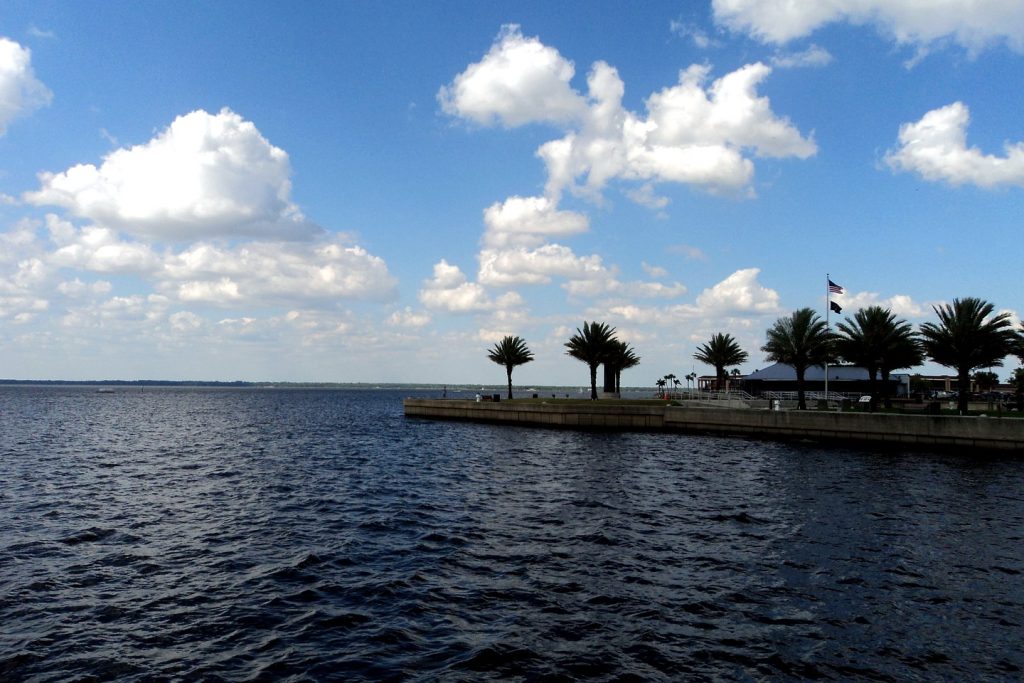
Photo: Lake Monroe at Sanford, on the St. Johns River — the featured photograph is the desk’s treated file photograph, carried from Tuesday evening’s report (Gabriel Vanslette, CC BY, via Wikimedia Commons).
Orlando Citizen by email
The weekly edition, in your inbox
One email, every Saturday: the week’s edition of Orlando Citizen — the week’s stories, rankings and winners, gathered in one place. Free, and you can unsubscribe at any time.
Related Stories
 WeatherOrlando Weather Today, Wednesday: Flood Warnings Now Cover Sanford and DeLand, Harney Forecast to Reach Major FloodingWeatherOrlando Weather Tonight, Tuesday: Flood Watch in Effect Through Friday, Flood Warnings Hold on the St. Johns RiverWeatherOrlando Weather Today, Tuesday: Flood Watch This Afternoon, Astor Forecast to Rise to 3.4 Feet by Sunday
Editor’s Picks
Spotted an error? Tell us — corrections · How we rank