Orlando Weather Today, Sunday: Sunny and 74, Flood Warning Holds on the St. Johns River
The National Weather Service in Melbourne has a Flood Warning in effect until further notice for the St. Johns River above Lake Harney in Seminole County and near Astor in Lake County. Orlando itself is sunny with a high of 74 and no rain today, Sunday, November 15.
5 minute read
Flood Warning — Seminole and Lake counties. The National Weather Service in Melbourne kept a Flood Warning in effect until further notice for the St. Johns River above Lake Harney in Seminole County and for the St. Johns River near Astor in Lake County, in statements issued Saturday evening, November 14. Both warnings were still in effect when this report was checked on Sunday morning, November 15. The next statements are due Sunday at 11:00 a.m. EST. Away from the river, Orlando’s Sunday is sunny and dry. The full forecast is below; the river comes first, because that is the order the Weather Service’s own products put it in.
Above Lake Harney, Seminole County: moderate flooding
The Flood Warning for the St. Johns River near Above Lake Harney, affecting Seminole County, remains in effect until further notice. The Weather Service reports that heavy rainfall has caused river levels on the St. Johns near Geneva, above Lake Harney, to reach Moderate Flood Stage, and that moderate flooding is occurring and is forecast to continue. At 7:30 p.m. EST Saturday the river stage was 9.0 feet — flood stage is 8.0 feet, and bankfull stage is 6.0 feet. The maximum stage in the 24 hours ending at 7:30 p.m. Saturday was 9.1 feet. The forecast is for the river to remain steady above flood stage at 9.0 feet, with levels expected to remain steady into next week.
At 9.0 feet, the Weather Service’s stated impacts are specific: water enters the first story of homes on Whitcomb Drive between Crossover Lane and Lake Harney Road, and water covers Mullet Lake Park. Our Sanford hub covers the Seminole County side of the river, and our earlier coverage of the Sanford Riverwalk and Lake Monroe — the lake the St. Johns flows through just downstream — gives the lay of the land.
Astor, Lake County: minor flooding
The Flood Warning for the St. Johns River near Astor, affecting Lake and Volusia counties, also remains in effect until further notice, with minor flooding occurring and minor flooding forecast. At 6:30 p.m. EST Saturday the stage at Astor was 2.6 feet — flood stage is 2.3 feet and bankfull stage is 2.0 feet — and the river is expected to remain steady above flood stage at 2.6 feet. The Weather Service says slight rises within Minor Flood Stage are forecast early next week, from a combination of northerly winds, downstream tidal effects, and water from upstream heavy rainfall working north through the basin.
The statement’s impacts, listed at the 2.8-foot level, include docks and boat ramps covered at South Moon Fish Camp and water approaching the sea wall at Blair’s Jungle Den; water approaching the sites closest to the river at Fish Tales RV Resort and Astor Landing Campground; a portion of Clair Street covered by river water south of the Butler Boat Ramp; docks underwater at the Astor Bridge Marina and along Riveredge Drive; portions of Fox Road covered nearest the river; and Acorn, Hazelnut and Redbud roads underwater with yards inundated. Lake County coverage runs through our Tavares hub, for the county seat, and the areas index.
What the Weather Service tells residents to do
The precautionary guidance in both statements is the same, and it is short: motorists should not attempt to drive around barricades or drive cars through flooded areas, and caution is urged when walking near riverbanks. No other watches or warnings were in effect for Orange, Seminole, Osceola or Lake counties when this report was checked on Sunday morning — the Weather Service’s summary for Orlando itself reads “No Active Hazardous Weather Conditions.” This desk will update when the 11:00 a.m. statements issue; every Weather report from this desk is filed in the Weather archive, and all twelve of the Citizen’s beats are indexed at /beats/.
Orlando weather today: sunny, high 74, no rain
For Orlando itself, the answer to “is it going to rain in Orlando today” is no. The National Weather Service Melbourne forecast for Sunday, November 15 is sunny with a high of 74 degrees and a 0 percent chance of precipitation. Tonight is partly cloudy with the overnight low near 58 and no rain expected. If you are heading to an outdoor plan today — it is the final day of the Winter Park Autumn Art Festival — the weather is not the obstacle. The exception is anywhere near the St. Johns River in Seminole or Lake County, where the warnings above apply.
The week ahead, as NWS Melbourne frames it
The Weather Service’s tabular forecast for Orlando for the next several days:
- Monday, November 16: partly cloudy, low 58, high 74, rain chance 10 percent.
- Tuesday, November 17: partly cloudy, low 63, high 75, rain chance 30 percent.
- Wednesday, November 18: partly cloudy, low 63, high 78, rain chance 30 percent.
- Thursday, November 19: sunny, low 64, high 79, rain chance 30 percent.
- Friday, November 20: partly cloudy, low 65, high 79, rain chance 20 percent.
- Saturday, November 21: partly cloudy, low 65, high 80, rain chance 20 percent.
No heat advisory is in effect or in the forecast — these are mild mid-November temperatures by Orlando standards — and the National Hurricane Center’s 1:00 a.m. EST Sunday outlook says there are no tropical cyclones in the Atlantic and tropical cyclone formation is not expected during the next seven days. River readers should note the one number that matters this week is not in the table above: the St. Johns is forecast to hold steady above flood stage at both warned points, and this desk’s next check follows the Weather Service’s 11:00 a.m. Sunday statements. For more of the region’s rivers, see our Wekiwa Springs guide — a separate river system, not under any warning.
Sources & notes
Every figure in this article comes from the National Weather Service forecast office in Melbourne, checked Sunday morning, November 15, 2026:
- Tabular State Forecast for East Central Florida, NWS Melbourne, issued 2:46 a.m. EST Sunday, November 15, 2026 (FPUS62 KMLB) — Orlando row: Sunday sunny, high 74, precipitation probability 0 percent; the Monday–Saturday outlook as listed above.
- Flood Statement, NWS Melbourne, 7:51 p.m. EST Saturday, November 14, 2026 — Flood Warning continues for the St. Johns River near Above Lake Harney, Seminole County: stage 9.0 feet at 7:30 p.m. Saturday, flood stage 8.0 feet, moderate flooding occurring and forecast, in effect until further notice, next statement Sunday 11:00 a.m. EST.
- Flood Statement, NWS Melbourne, 7:47 p.m. EST Saturday, November 14, 2026 — Flood Warning continues for the St. Johns River near Astor, Lake and Volusia counties: stage 2.6 feet at 6:30 p.m. Saturday, flood stage 2.3 feet, minor flooding occurring and forecast, in effect until further notice, next statement Sunday 11:00 a.m. EST.
- NWS watch/warning summary for Orlando, checked Sunday morning, November 15, 2026: no active hazardous weather conditions for Orlando; the two river Flood Warnings above are the active warnings touching the Citizen’s coverage counties.
- Atlantic Tropical Weather Outlook, National Hurricane Center, 1:00 a.m. EST Sunday, November 15, 2026: no tropical cyclones in the Atlantic; formation not expected during the next seven days.
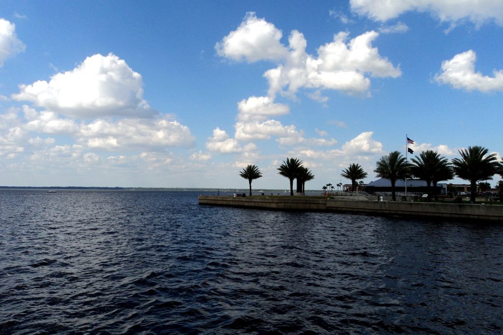
Photo: Lake Monroe at Sanford, on the St. Johns River in Seminole County. Gabriel Vanslette, CC BY, via Wikimedia Commons; magazine photo grade applied.
Orlando Citizen by email
The weekly edition, in your inbox
One email, every Saturday: the week’s edition of Orlando Citizen — the week’s stories, rankings and winners, gathered in one place. Free, and you can unsubscribe at any time.
Related Stories
 The PaperOrlando Airport Flights After the FAA Ground Stop: What Happened at MCO and What Sunday Looks Like
 The PaperHorizon West Development Plans: 600 Short-Term Rentals, 600 Apartments, or a Mix — One Winter Garden Site, Three Futures
 The PaperEast Orlando Development Plans: 322-Unit Multifamily Community Proposed in the East Colonial Corridor
Editor’s Picks
Spotted an error? Tell us — corrections · How we rank
