Where the Everglades Begin: Walking Shingle Creek from Hunter’s Creek
The northernmost headwaters of the Everglades run along Hunter's Creek's western edge. Two trailheads — one behind a middle school, one at Vista Park — open boardwalks, pine islands and a working cypress swamp.
3 minute read
Stand on the boardwalk in the Shingle Creek Management Area and the geography lesson lands all at once: the modest, cypress-lined creek sliding past your boots is generally considered the northernmost headwaters of the Everglades. From the western edge of Hunter’s Creek, Shingle Creek flows south into Lake Tohopekaliga and on through the Kissimmee Chain of Lakes — the first link in the great watershed that eventually feeds the River of Grass. The creek took its name in the late 19th century from the cypress trees along its banks, cut and split into shingles. Today more than 1,500 acres of its swamp, pine flatwoods and floodplain are protected in the management area, and Hunter’s Creek residents hold the two best keys to it.
Trailhead one: Hunter’s Creek Middle School
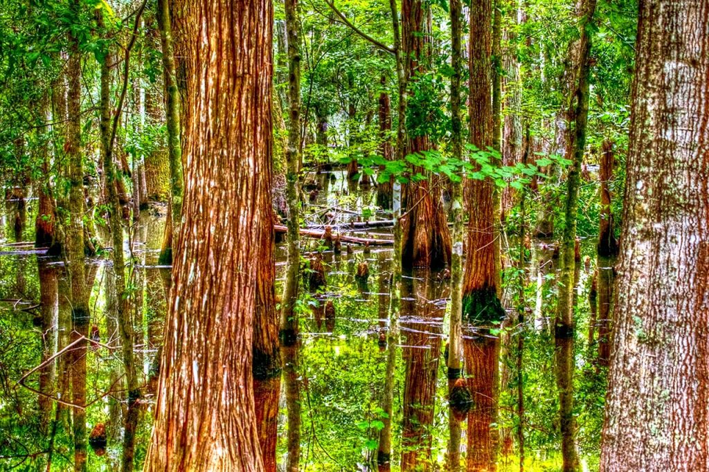
The creekside route starts behind Hunter’s Creek Middle School at 13400 Town Loop Boulevard. From the trailhead, a path runs along Shingle Creek itself — shaded, scenic, unpaved and rough in places, with boardwalks and wooden footbridges carrying you over the wet sections. This is the prettiest walking in the management area: cypress knees, still black water, and the creek close enough to watch. The catch is access. Because the trailhead sits on school grounds, it is closed during school hours and opens on non-school hours, weekends and holidays. Plan it as a weekend or early-evening walk, and check conditions after heavy rain — a floodplain trail earns its name in the wet season.
Trailhead two: Vista Park
The Vista Park trailhead, at 13042 Hunter’s Vista Boulevard in the Vistas village, is the flexible option: parking there is open to the public, though the park facilities themselves are for residents. Head south and a paved mile of the Shingle Creek Trail unspools toward Kissimmee. Head north, cross Hunter’s Vista Boulevard, and the route follows a powerline corridor — open, sunny, no shade — about four-tenths of a mile into the management area proper, where you can angle east back to the creek and the middle school route, or stay north for the Pine Island loops. The East and West Pine Island trails add roughly three miles of loops through pine flatwoods and prairie, a completely different Florida from the swamp: dry, bright and birdy.
What you will see
The management area is managed first as habitat and a wildlife corridor south to the Kissimmee lakes, and the recreation — hiking, eco-biking and mountain biking, paddling, fishing, picnicking, birdwatching and wildlife viewing — is layered gently on top. Boardwalks at the north and south ends are connected by trails through a mosaic of cypress swamp and pine islands. Expect wading birds in the shallows, turtles on the logs, and the understanding that alligators live here on their own terms; this is a working wetland, not a zoo, and the usual Florida rules about water’s edge apply. Photographers should come early, when the creek holds mist and the powerline corridor is still cool enough to enjoy.
Doing it well
Bring more water than the distance suggests, wear shoes that can get muddy, and give the powerline stretch the respect its lack of shade demands — in summer, walk it early or not at all. Bug spray is not optional in the wet months. There is no entrance station and no ranger kiosk at these trailheads; the experience is deliberately unbuilt, which is most of its charm. If you want the creek with a guide rail and a gift shop, Gatorland, just northeast of the community in Southchase, runs its own swamp boardwalks — but start here, where the Everglades actually begin. Both trailheads and the rest of this series are on the Orlando Top Spots Map, and our guide to Hunter’s Creek’s seven parks covers the greener, more manicured half of the neighborhood’s outdoors.
Few Orlando subdivisions can claim a continental watershed as their backyard. Hunter’s Creek can — and, to its credit, mostly leaves it alone.
Photo: Cypress swamp along Shingle Creek, at the western edge of Hunter’s Creek. Photo: R9 Studios FL, CC BY, via Flickr.
Orlando Citizen by email
The weekly edition, in your inbox
One email, every Saturday: the week’s edition of Orlando Citizen — the week’s stories, rankings and winners, gathered in one place. Free, and you can unsubscribe at any time.
Related Stories



Editor’s Picks
Spotted an error? Tell us — corrections · How we rank
