The Airport on the Boundary: Orlando Executive and Azalea Park
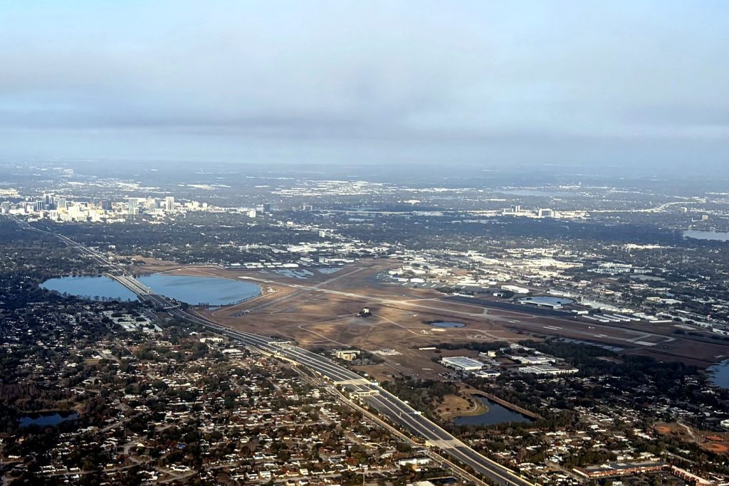
Orlando Executive Airport — Orlando's original municipal airfield — forms Azalea Park's northwestern boundary, with Lake Barton at its edge. The community that lives beside the runways.
1 minute read
The northwestern corner of Azalea Park does not end at a street. It ends at an airport: Orlando Executive Airport (ORL), whose runways and Lake Barton form the community’s boundary north of Lake Underhill Road. It is one of the more distinctive edges any Orlando community can claim — a working general-aviation airport as a next-door neighbour.
Orlando’s first airport
Executive is the elder of Orlando’s two airports: the city’s original municipal airfield, converted to a military base in the Second World War era and returned to civilian life as the region’s business and general-aviation field when the jets moved south to the former McCoy Air Force Base — today’s Orlando International, whose MCO code still carries McCoy’s name. Azalea Park grew up in the postwar decades beside the older field, and the sound of light aircraft is part of the neighbourhood’s ordinary weather.
What it means on the ground
For residents, the airport is boundary, landmark and compass — the open sky at the community’s corner, the reason the western view stays low and green. This hub’s photograph shows it from the air, labelled as what it is: the airport on Azalea Park’s western boundary, with downtown Orlando beyond. Communities are defined by their edges; Azalea Park’s northwestern edge happens to have runways.
Photo: Orlando Executive Airport, on Azalea Park’s western boundary, from the air, with downtown Orlando beyond. Photo: Dclemens1971, CC BY 4.0, via Wikimedia Commons.
Orlando Citizen by email
The weekly edition, in your inbox
One email, every Saturday: the week’s edition of Orlando Citizen — the week’s stories, rankings and winners, gathered in one place. Free, and you can unsubscribe at any time.
Related Stories

Editor’s Picks
Spotted an error? Tell us — corrections · How we rank
