Fern Park’s Lakes: The Water Inside the Suburb
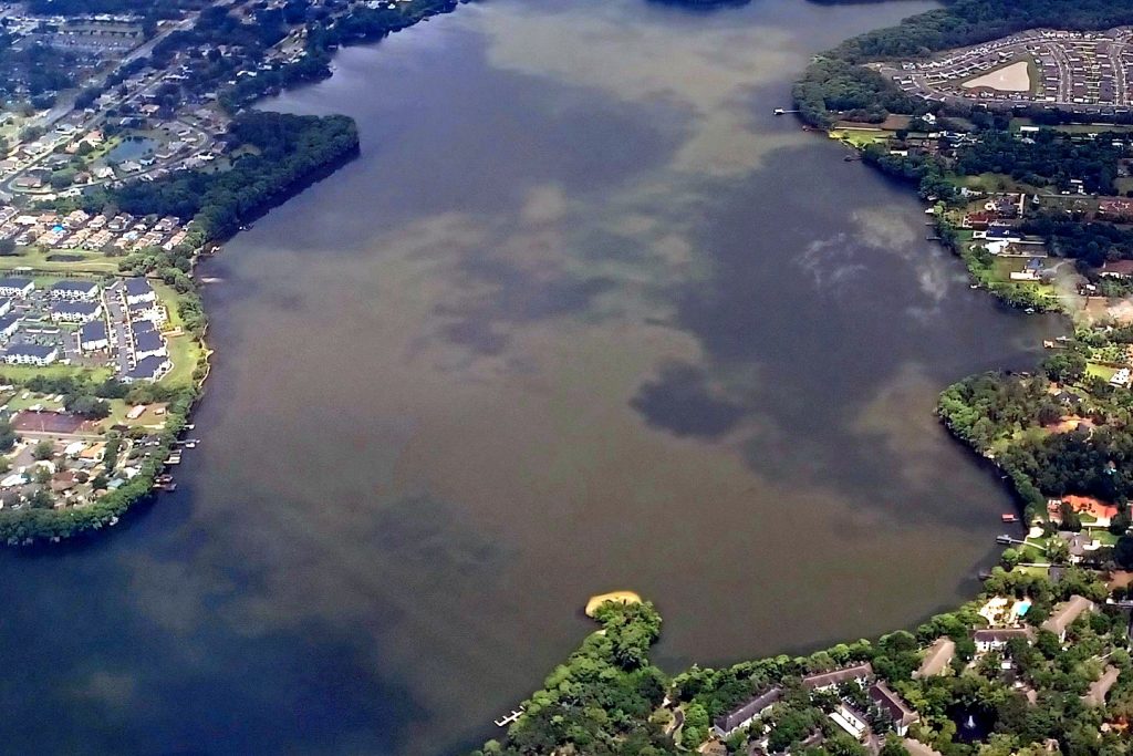
Better than an eighth of Fern Park is water — 0.32 square miles of it in a 2.32-square-mile community. The lakes bent the streets, named the neighbourhoods and still set the suburb's pace.
1 minute read
Read Fern Park’s census line closely and the place explains itself: of its 2.32 square miles, 0.32 — nearly 14 percent — is water. This is a suburb drawn around lakes, in the chain-laced country between Casselberry and Maitland where south Seminole County’s map is as much blue as green. The Fern Park hub covers the community; this piece covers the water inside it.
Streets that bend around shorelines
In Fern Park the lakes are not a park you visit; they are the geometry. Residential streets curve to shorelines, houses back onto water, and the canopy closes over both. It is the older Seminole pattern — settlement fitted to the lakes rather than the grid imposed over them — and it gives a small, dense community (about 4,090 people per square mile) a permanently unhurried feel a mile from the SR-436 corridor.
The big water next door
The largest lake in the immediate orbit, Lake Howell, lies just east in Casselberry — plainly a neighbour, not a Fern Park possession, and the Casselberry hub carries its aerial photograph. Fern Park residents use it the way they use everything in Casselberry: as their own, by proximity. For a resident’s purposes the distinction hardly matters; for this magazine’s, it does, and the labelling stays honest. What belongs to Fern Park itself is the pattern — small water everywhere, woven through the streets — and on a still evening, with the light on it, that is more than enough.
Orlando Citizen by email
The weekly edition, in your inbox
One email, every Saturday: the week’s edition of Orlando Citizen — the week’s stories, rankings and winners, gathered in one place. Free, and you can unsubscribe at any time.
Related Stories

Editor’s Picks
Spotted an error? Tell us — corrections · How we rank