Riding the South Lake Trail: Florida’s Hilly Answer to the Rail Trail
Most Florida trails are flat. This one climbs the Lake Wales Ridge, threads a chain of lakes and links Clermont to Winter Garden through a designated Trail Town. How to ride the South Lake Trail well.
3 minute read
Florida rail trails have a reputation: flat, straight, shaded, lovely, and about as challenging as a treadmill. The South Lake Trail breaks it politely. Running from Groveland through Clermont and Minneola to the West Orange Trail at Killarney Station, this paved route — a little over 12.5 miles end to end, and 15.5 in some trail listings that fold in the full Lake Minneola Scenic Trail — climbs and rolls over the Lake Wales Ridge, threads a chain of lakes, and passes through the middle of a designated Florida Trail Town. Here is how to ride it well. More Clermont context lives on our Clermont hub.
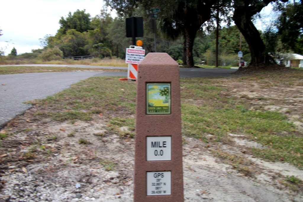
The waterfront miles: start at Mile 0.0
The ceremonial start is the stone marker at Mile 0.0, and the Clermont waterfront section is the trail’s greatest-hits reel: Waterfront Park’s beach and piers, Victory Pointe’s boardwalks, the downtown skyline of masts and rooftops above the shore. The city lists its Clermont/Minneola Trail segment at 5.2 paved miles from West Beach along Lake Minneola through Clermont and Minneola, reaching the Lake-Sumter State College and UCF campus — wide asphalt, lake on one side, and side streets dropping you into downtown Clermont for coffee whenever you want it. We cover the parks themselves in our Lake Minneola waterfront guide; from the saddle, the thing to know is that this stretch is flat, social and scenic — save your legs here.
East of Minneola, the ridge wakes up
Past Minneola the trail turns inland onto the Central Florida sand ridge, and the character changes: wooded valleys, open vistas, and grades that will genuinely test a Florida cyclist’s gearing. The route crosses US-27 by bridge, picks up the Hancock Trail junction — nine more hilly miles popular with road riders — and rolls on to Killarney Station, where the South Lake Trail hands off to the 22-mile West Orange Trail into Winter Garden. Link them and you have roughly 36 continuous paved miles; ambitious riders treat Clermont as the western anchor of a Winter Garden lunch run, with the hills saved, cruelly, for the return.
Why Clermont takes trails personally
This is infrastructure the town has organized itself around. The Florida Greenways and Trails System designated Clermont a Trail Town in 2018; the city is also certified as a Runner-Friendly and Bicycle-Friendly Community, and it sits at the halfway point of the Florida Coast-to-Coast Trail, the cross-state route the South Lake Trail helps carry. The city counts about 7.28 miles of trail within its limits, with restrooms, water fountains, benches and wayfinding along the route, plus two master-plan pieces worth knowing: the Legacy Loop Trail, tying the trail into the downtown core through Victory Pointe, and the Meet Us in the Middle Plaza, a trailhead marking the Coast-to-Coast midpoint. Trailhead parking is easiest at Waterfront Park and the Minneola Trailhead Park.
A note on distances, since sources differ: Lake County’s own materials put the South Lake Trail at slightly over 12.5 miles, while TrailLink’s route, which runs the full Lake Minneola Scenic Trail alignment from Groveland’s CR 565A to Killarney Station, measures 15.5. The discrepancy is endpoints, not error — either way, budget for a half-day ride if you take the ridge both directions, and a full one if Winter Garden is the lunch plan.
Practical notes before you clip in
There is no fee and no permit; the trail is open to riders, runners, walkers and skaters. Ride the ridge sections early in summer — the inland miles have less breeze than the lakefront and the grades compound the heat. Carry more water than a flatland trail has taught you to. And if the hills surprise you, take comfort in the company: this is the same terrain the professionals come for, as our training-town piece explains. The South Lake Trail is not Florida’s longest or prettiest trail. It is the one that proves the state has a third dimension. Find its trailheads on the Orlando Top Spots Map.
Photo: DanTD, CC BY-SA 3.0, via Wikimedia Commons.
Orlando Citizen by email
The weekly edition, in your inbox
One email, every Saturday: the week’s edition of Orlando Citizen — the week’s stories, rankings and winners, gathered in one place. Free, and you can unsubscribe at any time.
Related Stories



Editor’s Picks
Spotted an error? Tell us — corrections · How we rank